


In a previous article, I described my favorite hikes around Anchorage. In this article, I describe five hikes further south from Anchorage on the stunning Kenai Peninsula. The scenery couldn’t be more dramatic than the soaring peaks and water views of the Cook Inlet and Gulf of Alaska. These five hikes on the Kenai Peninsula …
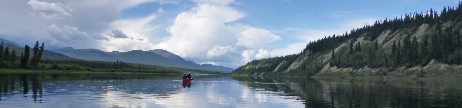
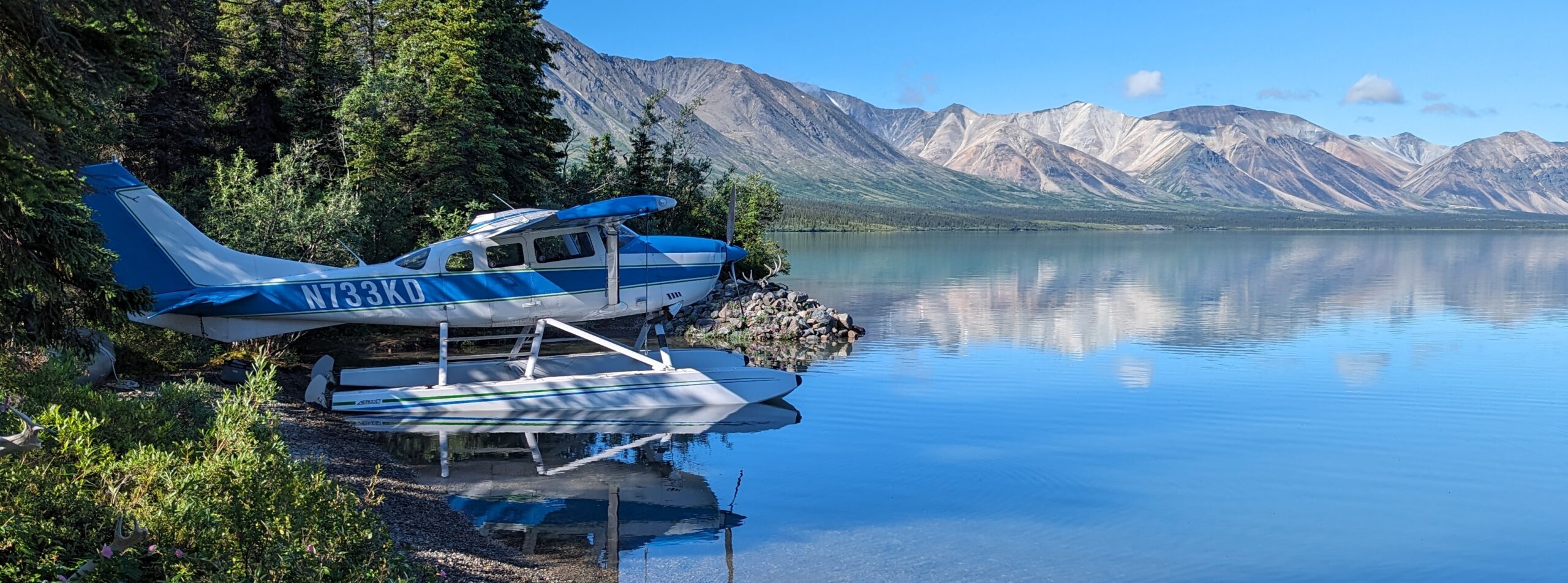
Alaska has long been a favorite destination of mine. I love the majestic mountains, remoteness, lingering pioneer spirit, and softly angled light. I’ve flown in and out of Anchorage, Juneau, Fairbanks, and Whitehorse, Yukon, but never spent much time around Anchorage, using it as a launching point for other adventures. Over the last two years, …
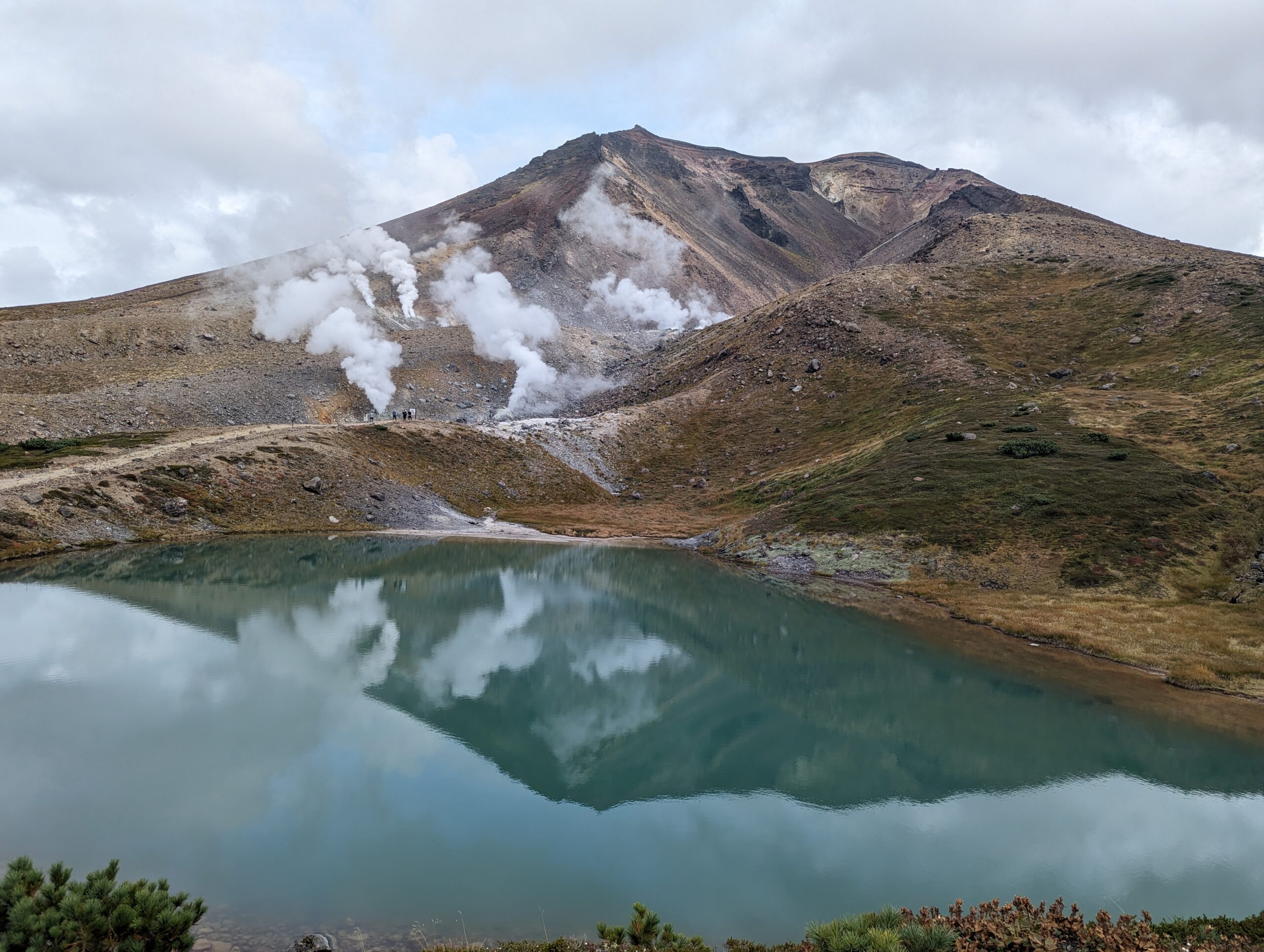
The hiking in Daisetsuzan National Park on the island of Hokkaido is sublime, featuring bubbling hot springs, steaming, otherworldly fumaroles, dramatic volcanic landscapes, wildflowers, and thick forests. During our week in Hokkaido, we visited Sapporo and spent two days in Daisetsuzan National Park, taking public transportation to get around. We were able to do three …
Yosemite National Park is one of the most popular national parks in the US, with visitors flocking to Yosemite Valley to see the massive granite faces draped with ethereal waterfalls dropping hundreds of feet in swirls of frothy mist. It’s often possible to escape the crowds by hiking a mile or two beyond the lookout …
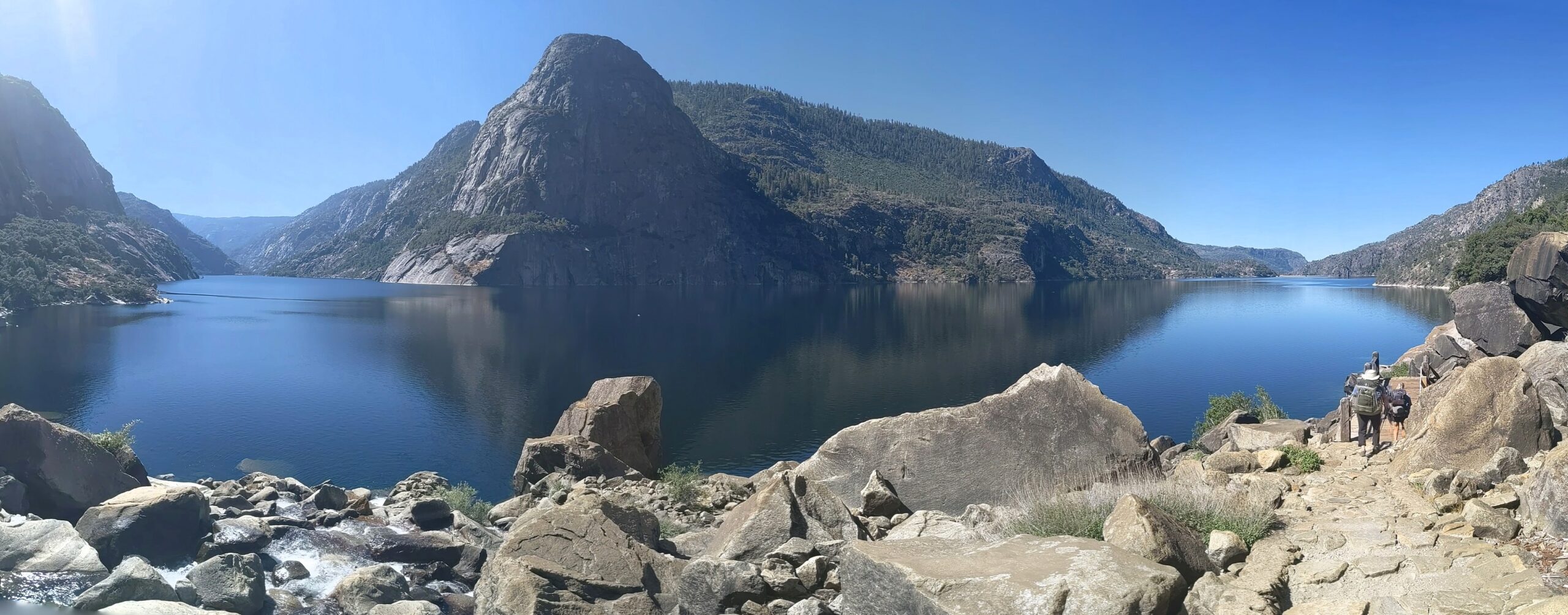
Backpacking Hetch Hetchy to Rancheria Falls is a great way to kick off a summer backpacking season in Yosemite National Park. It’s best hiked in the spring when temperatures are reasonable but not so early that snowmelt creates dangerous conditions in streams that cascade into Hetch Hetchy Reservoir. Another good time to hike here is …
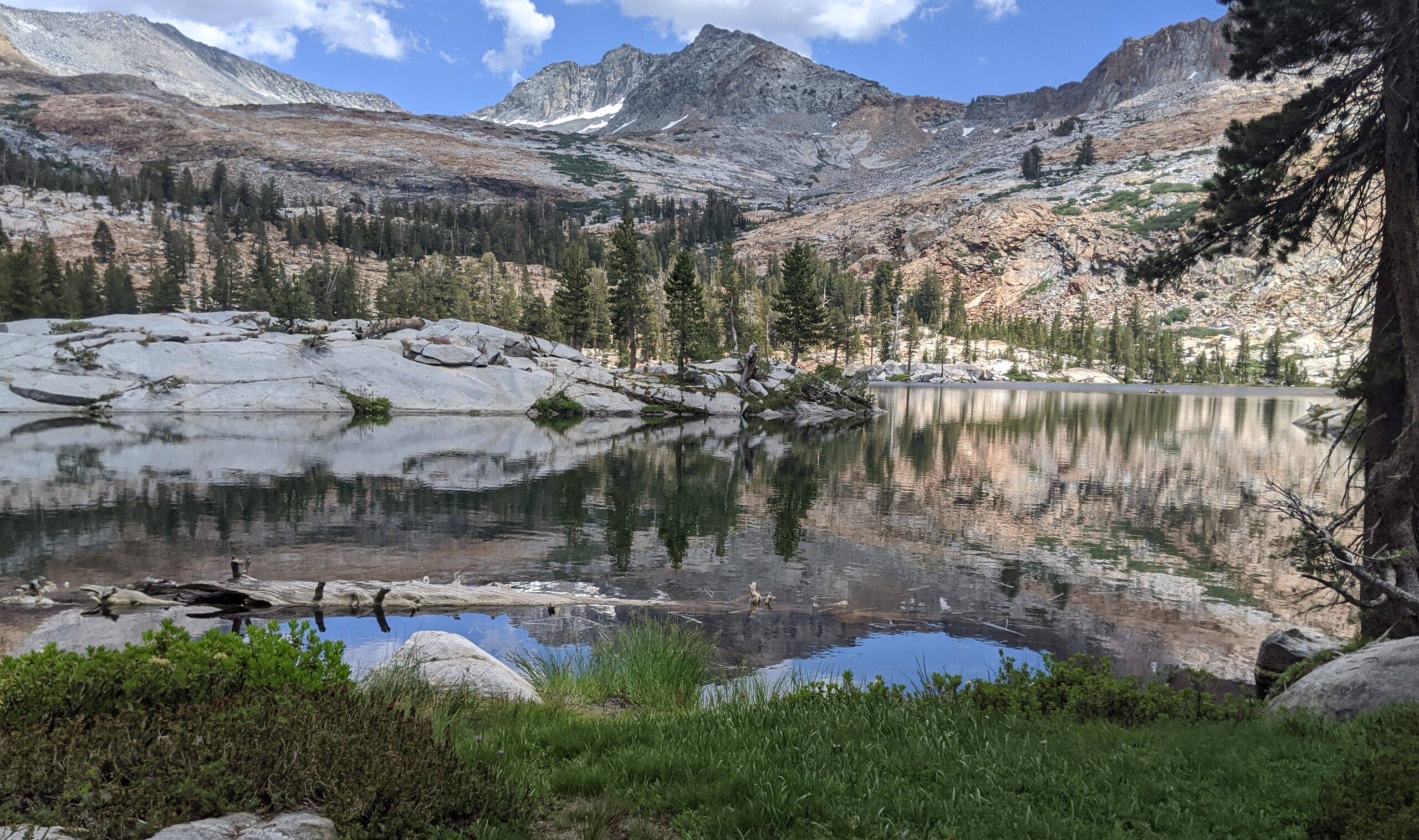
Backpacking the Grand Canyon of the Tuolumne route in Yosemite National Park turned out to be harder to accomplish than I expected because of repeated fires interrupting my plans. In the four years that it took to hike the 30-mile trail, I might have held ten permits, repeatedly changing them in the hopes that smoke …
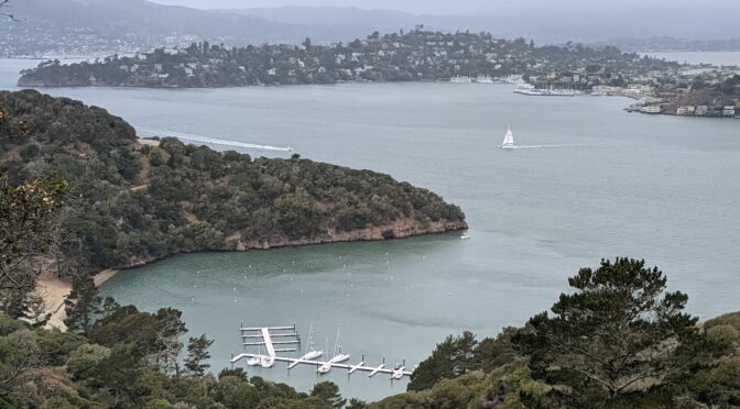
So many wilderness permits, so many cancellations. The last two years have been tough for planning between the pandemic, wildfires, smoke and other issues. I salvaged one backpacking trip that was supposed to be in the Sierra by snagging a back-up to the back-up permit for an easy backpacking trip to Angel Island State Park …
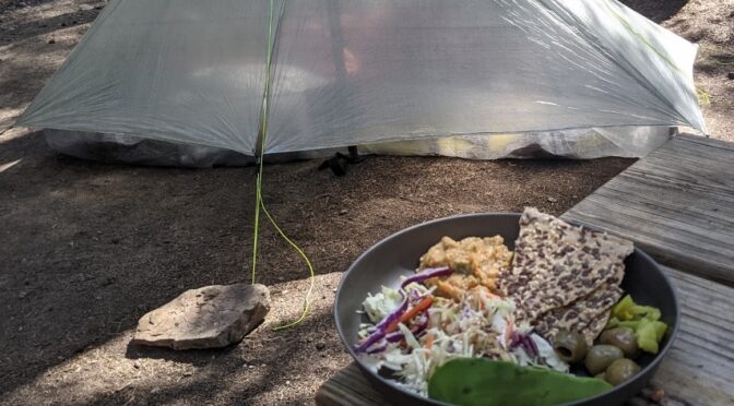
I’ve been experimenting with stoveless backpacking food and find that I’m drawn to foods I would normally eat without heating. A variety of different tastes and textures can be achieved by creating stoveless trail deli plates. There are endless combinations that are possible. If it’s a weekend trip in relatively cool temperatures, fresh foods such …
Kuhl makes pants for women and men that can work equally well for travel, hiking and backpacking. The fabric and quality of construction means that they are rugged enough for the backcountry and tailored enough to look good in town. I tried the Kuhl Trekr pants for women and found a great fit and excellent …
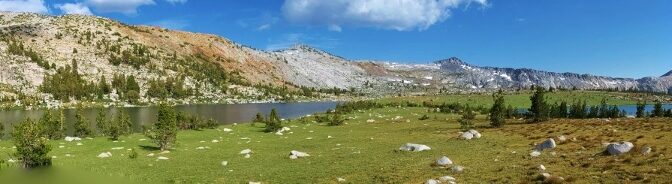
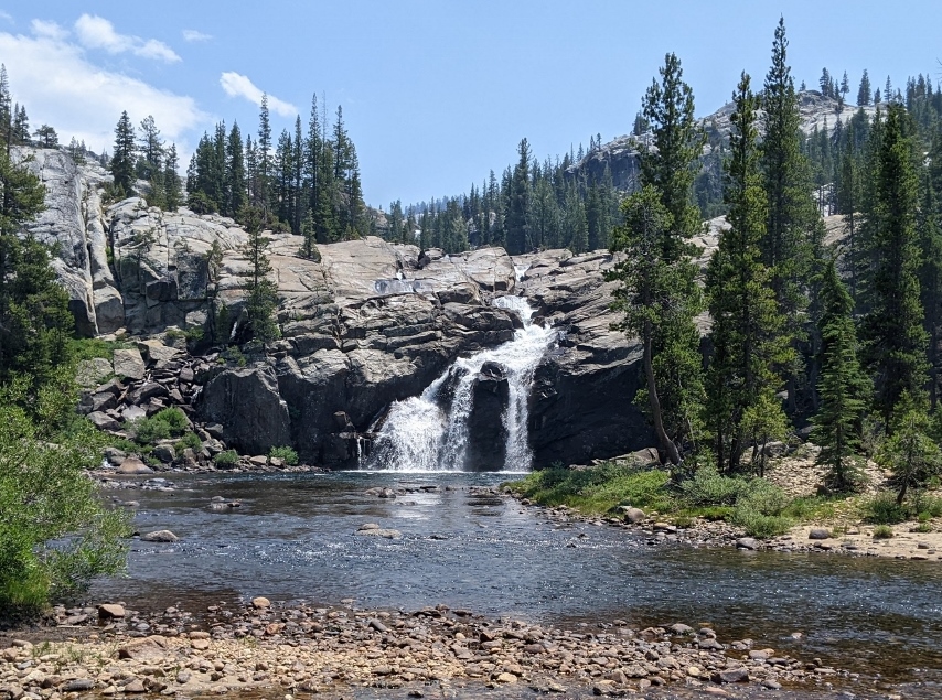
Glacier Point is graced with some of the most stunning views in Yosemite National Park, with a panorama of peaks, valleys and waterfalls, including the iconic Half Dome rock formation front and center. There could hardly be a more spectacular start to a multi-day hike. Add to that a plethora of trailheads and potential routes …