


Yosemite National Park is one of the most popular national parks in the US, with visitors flocking to Yosemite Valley to see the massive granite faces draped with ethereal waterfalls dropping hundreds of feet in swirls of frothy mist. It’s often possible to escape the crowds by hiking a mile or two beyond the lookout spots, or even sleeping under the stars in the wilderness. Here are three different hikes in Yosemite National Park for spring, summer or fall. For each route, you can choose to hike a short distance for a day hike, or extend it for an overnight backpacking trip.
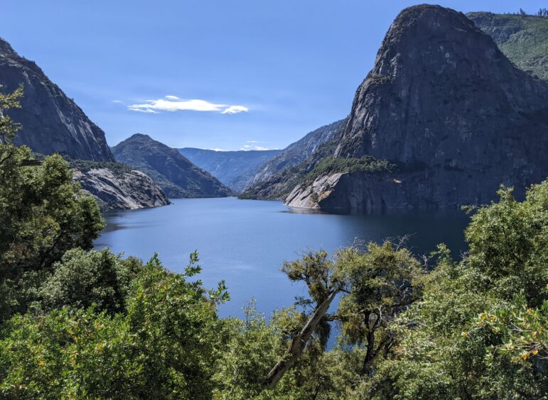
Hetch Hetchy is one of the least visited areas of Yosemite National Park. It’s also one of the most unique, holding in its granite arms the pristine water source for San Francisco. Construction on the controversial reservoir was completed in 1918, capturing water from the Tuolumne River watershed that drains the northern part of the park.
At 3,900 feet, Hetch Hetchy is lower than many other areas of Yosemite, so it’s one of the first areas that is clear of snow for hiking and backpacking outside of Yosemite Valley in the spring and latest to be accessible in the fall. Most of the hikes in this area start by crossing the O’Shaughnessy Dam, which has some interesting interpretive signs, to access a tunnel that leads to a trail located well above the shoreline of the reservoir.
Wapama Falls is a five-mile round-trip undulating day hike that follows the northern edge of the reservoir. Hikers first pass Tueeulala Falls, then cross the bridge at Wapama Falls before turning back. In early spring, when snowmelt is at its peak, the trail may be closed before the falls for safety reasons.
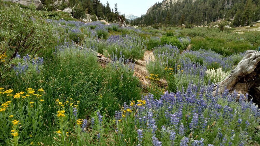
Backpackers can continue past Wapama Falls to the Rancheria Creek camping area, a distance of six miles one-way (12 miles round-trip). There are no amenities and it’s not an official campground, but there are many large campsites in a well-used level area between the trail and Rancheria Creek. It can be hot in the summer, but tall incense cedars and pine trees shade the campsites. A lazy afternoon can be spent frolicking in the many cascades and pools where water slides over rock slabs in Rancheria Creek.
From the camping area, it’s another 0.45 miles to Rancheria Falls, which makes a nice destination for a day hike from the camping area. The trail continues across a bridge if a longer day or multi-day hike is desired, leading into the vast network of trails in the steep canyons of Northern Yosemite.
The wilderness permit for Rancheria Creek is Rancheria Falls, the exit would be the same and the first night campsite could be listed as Rancheria Creek or anywhere beyond Tiltill Creek bridge.
Hetch Hetchy is 38 miles and takes about 1.5 hours to drive there from Yosemite Valley. The Hetch Hetchy Road begins just outside of the park on Highway 120, near the Big Oak Flat Entrance Station near Groveland. There is plenty of parking at the dam and a backpacker’s camp is near the dam.

Glacier Point is one of the iconic viewpoints of the park and may be the second most visited place after the Valley. Crowds of people disgorge from buses and cars to gaze at the unparalleled beauty from all directions, including the magnificent views of Half Dome, Yosemite Falls, Vernal Falls, Nevada Fall, Yosemite Valley, and the high country. Most will not stray far from the Visitor Center.
The Four Mile Trail is a steep trail that connects Glacier Point to Yosemite Valley following the path of an old toll trail that was completed in 1872. They rounded down when they named Four Mile Trail so it’s closer to five miles (4.8 miles). The views of Yosemite Falls and the Valley from the trail are outstanding. If you can get a ride up, it’s a fun hike down. If you choose to hike up, it’s a strenuous workout. There is no free shuttle, so arrange a ride in one direction or plan to do a round trip by foot.
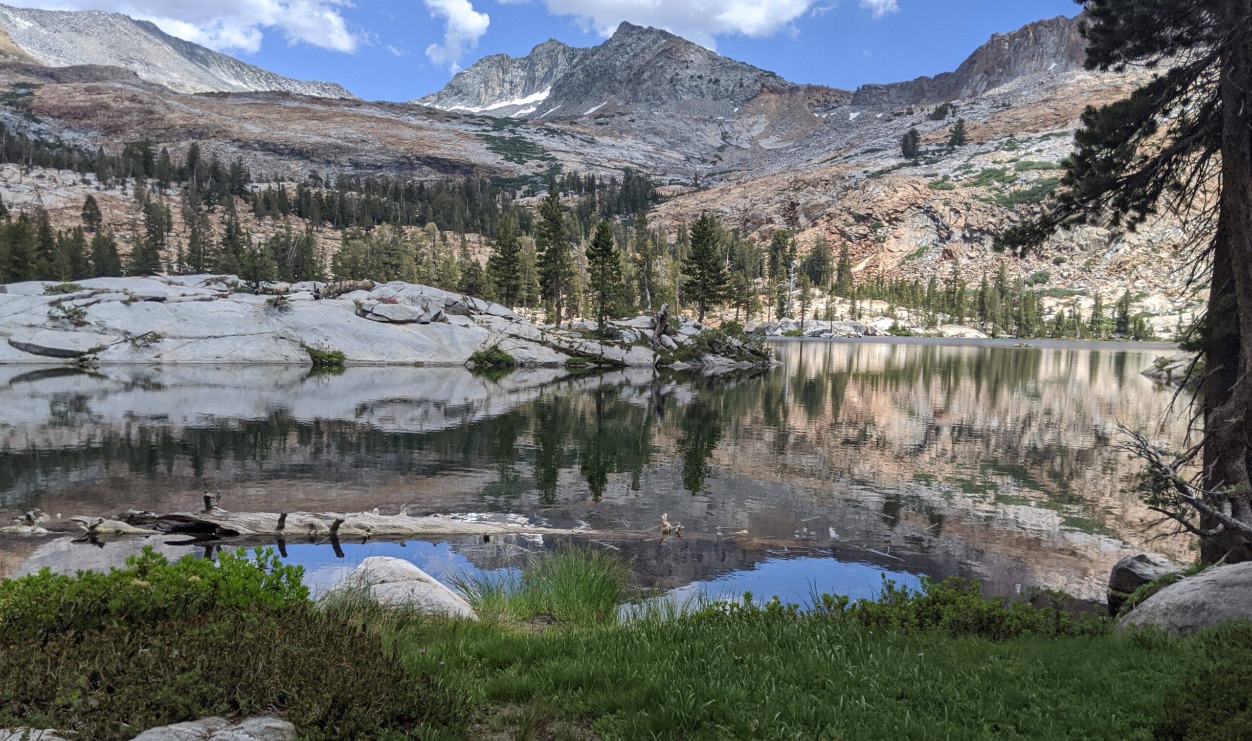
Going in the opposite direction from Glacier Point is the enticing rockbound Lower Ottoway Lake for the intrepid backpacker. At 14 miles one-way (28 miles round-trip), it could either be one long day or two shorter days to reach the lake. Backpackers will find a plethora of pleasant campsites and plenty of water along Illiouette Creek to break up the journey. Once at the lake, wet rock ledges dripping from Upper Ottoway Lake support many wildflowers and lodgepole pines fringe rocky slabs that provide perfect durable tent sites at the lower lake.
The wilderness permit for Ottoway Lakes is Glacier Point-Illilouette, the exit would be the same and the first night campsite could be listed as Lower Illilouette Creek.
Glacier Point is 30 miles and takes about one hour or a little less to drive from Yosemite Valley on Highway 41.
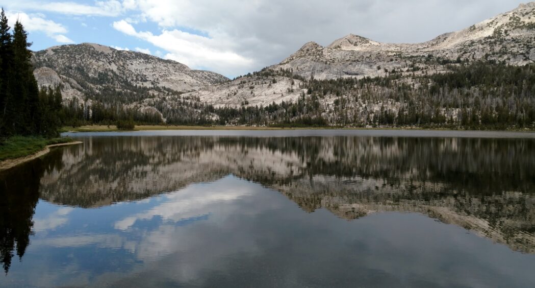
Once the snows melt and Tioga Road opens through the High Country, visitors crowd the trails to Glen Aulin and Lembert Dome on the north side of Tioga Road. A lovely two-mile day hike to Elizabeth Lake can be accessed from the Tuolumne Meadows campground heading south. The official trail ends at charming Elizabeth Lake under the brow of Unicorn Peak, but a social trail continues into a forest-fringed box meadow sitting in the embrace of the massive granite walls of Johnson Peak, Cockscomb Peak and Unicorn Peak, all part of the Cathedral Range. The glacier-carved lake basin is the perfect spot for a picnic with shallow cold water for splashing.
There is no camping around Elizabeth Lake, but for the adventurous backpacker with good navigation skills, continuing from Elizabeth Lake to Nelson Lake is an excellent introduction to cross-country travel in a relatively safe environment. “Relatively” because there is no trail and “safe” because the route is within the confines of the national park. You can’t get very far off track before running into a well-established trail, though it might mean a night of being in the wilderness but not at Nelson Lake if you get misplaced. The Nelson Lake wilderness permit is one of only two in the park that is for a destination not served by an official trail and provides an opportunity to experience wilderness at a deeper level than staying on a defined trail. The reward is a beautiful alpine setting with a shallow lake warm enough for swimming and a stunning backdrop of the informally named Choo-Choo Ridge soaring behind the water.
To find a route to Nelson Lake, a good topographic map, and an understanding of how to read it is necessary. Armed with these tools, it’s possible to plot a route that follows natural drainages and low angled hillsides to reach the serene lake. Or you can get the guidebook listed below for detailed instructions.
Tuolumne Meadows is 55 miles and takes about 1.5 hours to drive from Yosemite Valley on Highway 120.
Permits are not required for day hikes in Yosemite National Park except Half Dome, which has a lottery to distribute tickets. Camping in a campground requires a reservation, which is highly competitive. Overnight camping outside of a campground requires a wilderness permit, which is obtained from Recreation.gov through a weekly lottery. The process is described in detail on the Yosemite National Park website. Some wilderness permits are competitive, but the hikes listed here are not usually difficult to obtain.
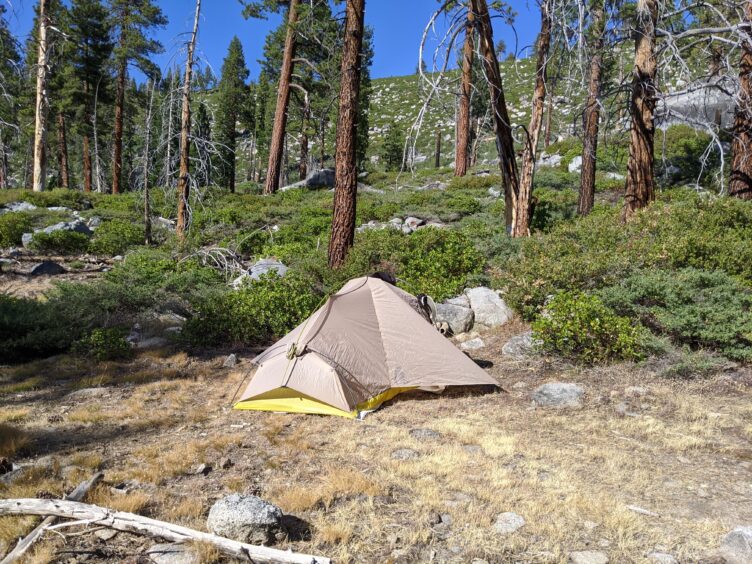
Wilderness permits are issued for the trailhead where an overnight trail starts. These are shown graphically on the Wilderness Trailheads Map. On the map, colored arrows show how far a trekker must hike on the first day, but beyond that, there are few restrictions beyond the basics. Basic guidelines are to camp at least 100 feet from trails or water sources, store food in a bear-proof canister and pack waste and toilet paper and out. Backpackers may establish a base camp for a day or more or continue hiking for many days in the wilderness. The author has hiked from Yosemite to Lake Tahoe to the north and from Yosemite to Mt Whitney to the south.
Hikers and backpackers have a unique opportunity to explore Yosemite National Park and create their own adventures in the wilderness when armed with a map and plan. With these three hikes in Yosemite Nationa Park, there’s an opportunity to explore a different area.
Tom Harrison Topographic Map: Yosemite High Country (for Tuolumne Meadows and Glacier Point)
Tom Harrison Topographic Map: Hetch Hetchy
Yosemite National Park: Your Complete Hiking Guide by Elizabeth Wenk and Jeffrey P. Schaffer