Backpacking Hetch Hetchy to Rancheria Falls is a great way to kick off a summer backpacking season in Yosemite National Park. It’s best hiked in the spring when temperatures are reasonable but not so early that snowmelt creates dangerous conditions in streams that cascade into Hetch Hetchy Reservoir. Another good time to hike here is when things cool off in autumn.
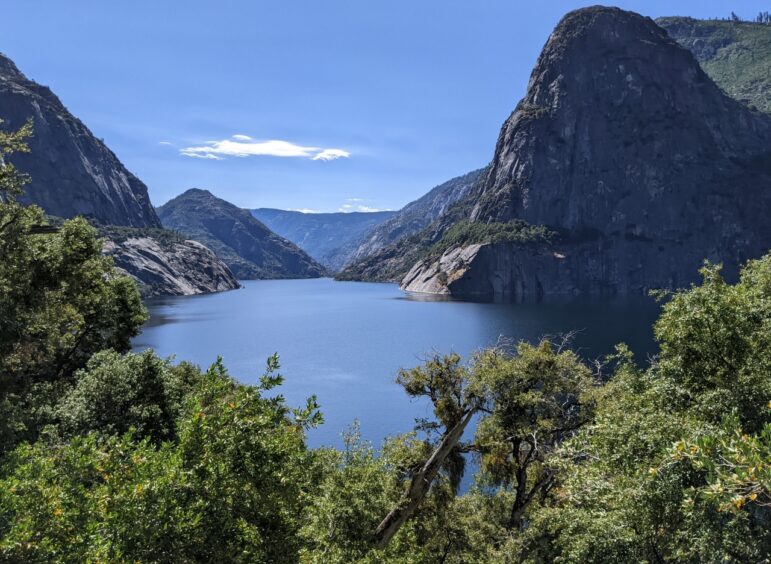
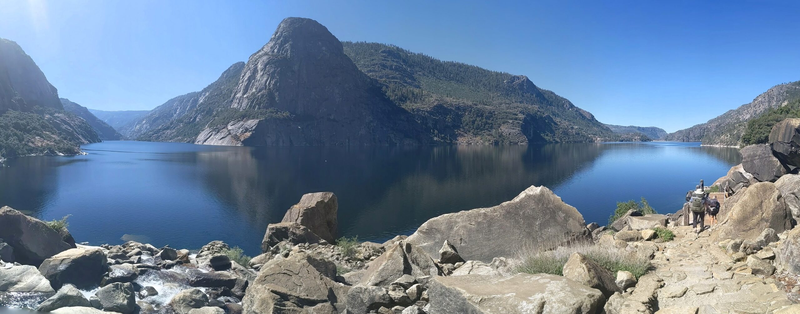
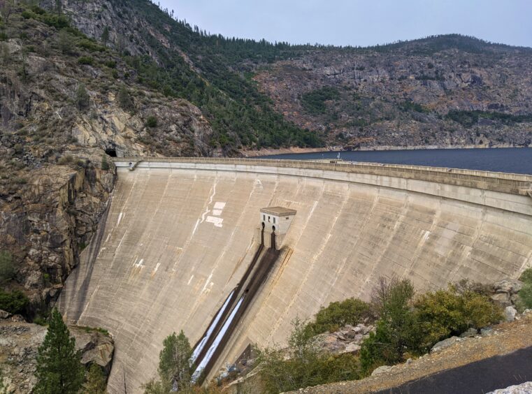
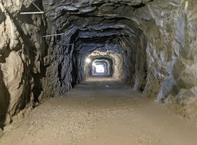
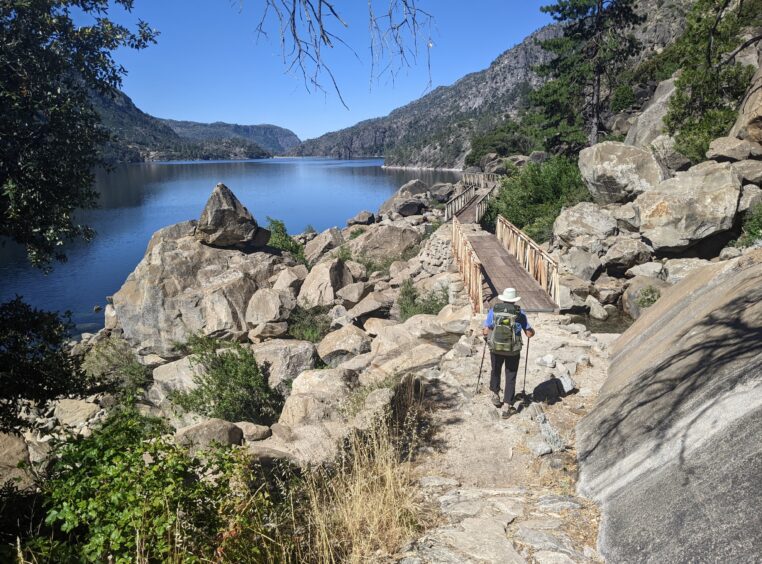
At 3,900 feet, Hetch Hetchy is lower than many other trails in Yosemite. It’s one of the first areas that are clear of snow for backpacking in spring and the last to accumulate early snow in fall. The trail runs along the edge of the reservoir, though not close enough to dip a toe in. Expansive water views up the canyon draws the hiker onward. Construction on the controversial reservoir that provides drinking water for San Francisco was completed in 1918, capturing water from the Tuolumne River watershed that drains the northern part of the park. The hike begins by crossing O’Shaughnessy Dam to a tunnel that leads to the trail along the water.
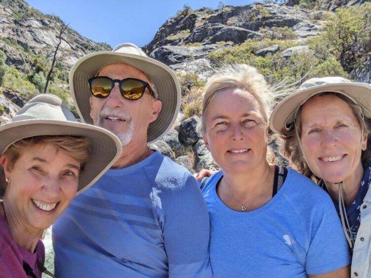
We started our hike on June 28, which was later than ideal. A week earlier or later would have been fine, but we hit it during an early heat wave. Temperatures soared into the 90s, making it an uncomfortably hot hike to the falls.
I requested a permit for the Rancheria Creek trailhead at the earliest date, 168 days before our planned start, and won the weekly lottery. See my article on how to get a permit here (the process is the same on the John Muir Trail and you can ignore the non-Yosemite sections).
We stayed at the comfortable and clean Buck Meadows Lodge in Groveland the night before. The amenities of air conditioning, a pool and adjacent restaurant were welcome. Backpackers can stay at the backpacker’s camp at Hetch Hetchy.
Groveland is close to the Big Oak Flat entrance to Yosemite. We picked up our reserved wilderness permit there the day before our hike. Permits are also released at the small kiosk at the Hetch Hetchy entrance to the park.
See my article on Sonora andGroveland: Gateway to Yosemite.
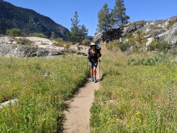
The hike from Hetch Hetchy is an undulating six miles (12 miles round trip) to the Rancheria Creek camping area. There are many large campsites in this well-used flat area between the trail and Rancheria Creek. However, this is not an official campground and there are no amenities (no water spigot, no toilets and no bear box). A bear-proof food canister must be carried.
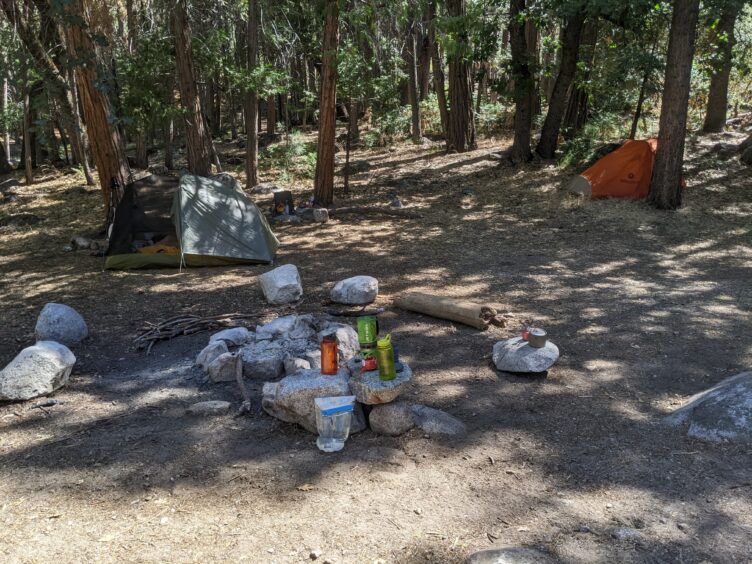
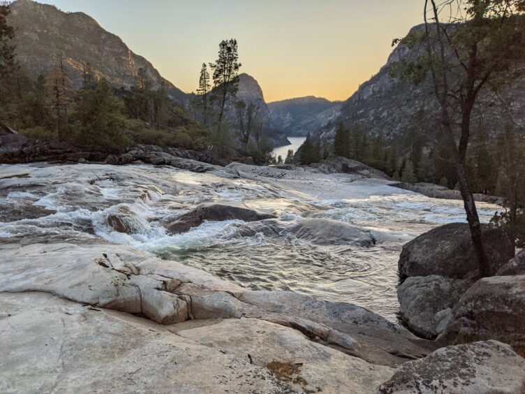
We stayed at the camping area for two nights, frolicking in the many cascades and pools where water from Rancheria Creek slides over rock slabs. The water was chilly, as always, but in the 90+ F heat, it was perfect.
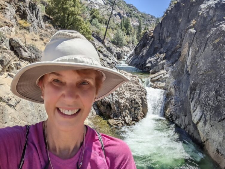
The second day, we hiked the short distance (0.45 miles) up to Rancheria Falls and continued for about an hour more to check out the trail beyond the bridge. The trail was well constructed, but the further we climbed, the overgrown vegetation showed that the trail has not been used as much as the previous section. When we returned to our camp, we gratefully sank into the refreshing water of Rancheria Creek to wash off the sweat and grime.
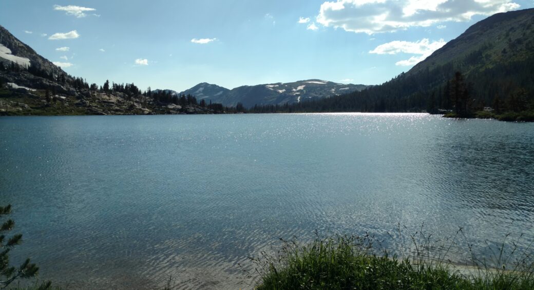
Northern Yosemite is a wild land filled with steep-walled, V-shaped canyons to test the strongest legs. Gorgeous alpine lakes invite a leisurely afternoon siesta. From Rancheria Creek, wide-ranging loops can carry hikers to the northern boundary of the park and beyond. Look at a map or the Yosemite National Park guidebook (see below), to plan a Rancheria-Bear Valley-Tiltill Valley Semi-loop, Lake Vernon-Laurel Lake Loop, Kerrick Canyon-Pleasant Valley-Rodger’s Canyon route, Tilden Lake loop and other routes up to Jack Main Canyon, Dorothy Lake and all the way to Tahoe on the Pacific Crest Trail.
See my article on Sonora Pass to Yosemite on the PCT.
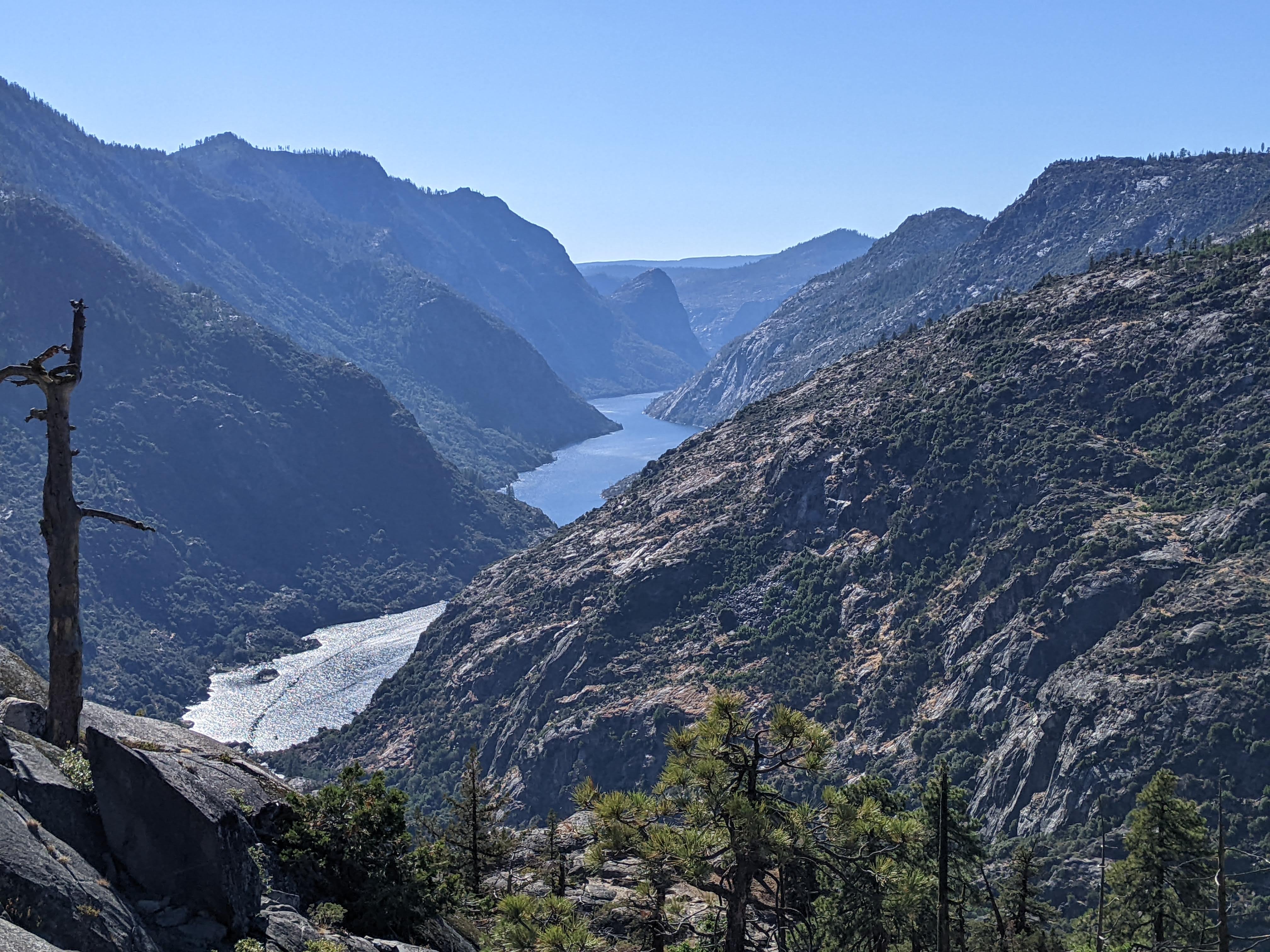
The Grand Canyon of the Tuolumne does not start at Hetch Hetchy, but there’s a spot near that trail that invites the hiker to gaze down at the far end of the reservoir near Rancheria Creek. I hiked the Grand Canyon of the Tuolumne a few weeks after we stayed at Rancheria Creek, and it provided yet another perspective of this amazing watershed. One entrance to the Grand Canyon of the Tuolumne is at White Wolf off of Tioga Road.
See my article on Backpacking the Grand Canyon of the Tuolumne in Yosemite.
The wilderness permit trailhead for the Rancheria Creek overnight hike is Rancheria Falls, the exit would be the same and the first night campsite could be listed as Rancheria Creek or anywhere beyond Tiltill Creek bridge.
Hetch Hetchy is 38 miles and takes about 1.5 hours to drive there from Yosemite Valley. The Hetch Hetchy Road begins just outside of the park on Highway 120, near the Big Oak Flat Entrance Station near Groveland. There is plenty of parking at the dam and a backpacker’s camp is near the dam.
Backpacking Hetch Hetchy to Rancheria Falls is a wonderful overnight hike in spring or fall in Yosemite National Park.
Tom Harrison Topographic Map: Hetch Hetchy
Tom Harrison Topographic Map: Yosemite High Country (for the area beyond the overnight hike)
Guidebook: Yosemite National Park: Your Complete Hiking Guide by Elizabeth Wenk and Jeffrey P. Schaffer
* * *
Explore more adventures in Yosemite National Park at IngasAdventures.com