


The Echo Chalet at Echo Lakes has a small store and deli.
This trip report represents the first half of our Echo Lakes to Yosemite hike: Tahoe to Sonora Pass on the PCT. My last trip report turned into a book, literally (see Highs and Lows on the John Muir Trail), so I tried to limit myself to the bare-bones facts to provide a quick review of each day. It’s not enough to do it justice but it’s a start.
For this southbound (SOBO) hike from Echo Lakes in Tahoe to Tuolumne Meadows in Yosemite, we decided to leave our car in the Tuolumne Meadows Wilderness Center so it would be there when we finished. While it is possible to travel from Yosemite to Tahoe using public transportation, we were lucky to have a friend who drove us there.
For information about permits and planning, please refer to these articles. The second article, in particular, has our exact itinerary that can be cross-referenced with this trip report. Mile markers (e.g. Mile 1072) refer to the PCT mileage provided by Halfmile, measured from the start of the PCT in Campo, CA.
For context, we started hiking on August 22, 2017. The 2016-2017 winter had been huge with near-record-breaking snowfall. It was wetter than usual, even at our late date, and it’s likely that some seasonal streams were still active that are usually dry. We had planned a late-July start but the rivers had been running high and significant snow lingered in the high mountains so we delayed a month.
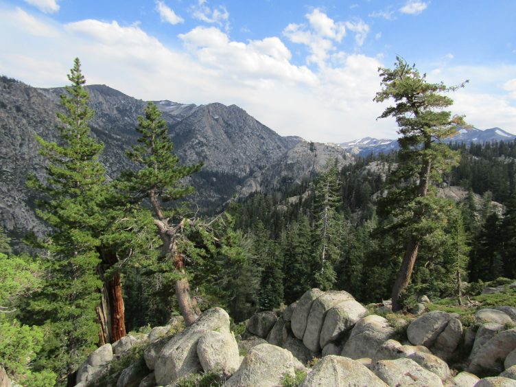
First night campsite near Echo Summit. Through the trees you can see a sliver of Lake Tahoe from the campsite.
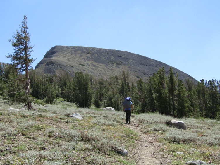
5 miles, Echo Lakes to below Echo Summit
Start: Mile 1092; End: Mile 1087 (Halfmile Maps)
The automobile trip from Lee Vining to Echo Lakes took half the day. By the time we arrived at Echo Lakes, black, threatening thunder clouds were piling in. We took a quick minute to admire the azure waters of Echo Lakes, sped through the small store for last minute treats and started walking.
The trail meandered by some cabins, crossed Highway 50 and ascended through the forest to Echo Summit. With thunder echoing off of the canyon walls, it was a quick five miles to where our first campsite should be. We were climbing up a steep, narrow canyon that looked highly improbable for finding a flat place to sleep, but suddenly there was an opening. A large campsite that could hold several tents (and some gnomes, perhaps) appeared out of nowhere. A wildflower-lined creek gurgled nearby and a couple of tent sites could be seen nestled into the trees on the other side (and there were additional campsites a little further upstream). We set up our tent just as the rain and hail let loose. Later that evening we saw a tent across the stream so someone must have come in during the storm. We never saw the person.
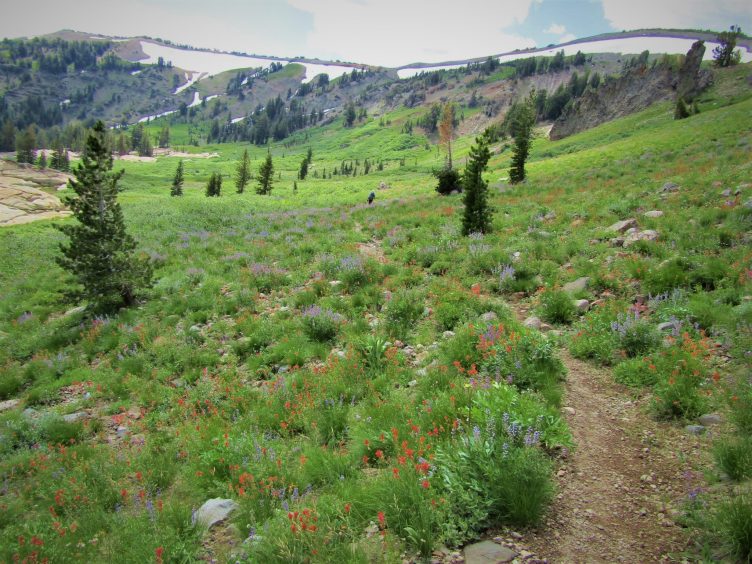
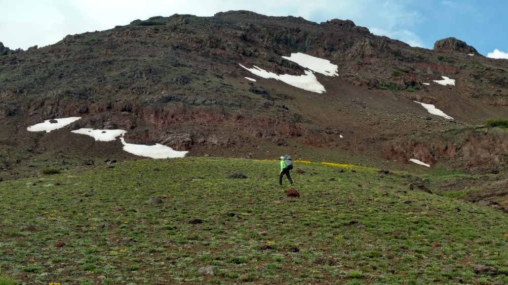
Just one of many days of non-stop wildflowers
5 miles, Echo Summit to Showers Lake
Start: Mile 1087; End: Mile 1082 (Halfmile Maps)
Under a cloudless blue sky, we continued our ascent up the narrow canyon, crossing the creek several times. Shortly, we topped out, traversing a hill that was loaded with more wildflowers than I had ever seen in the Sierra. Here it was, the beginning of August and there were masses of purple lupine, red paintbrush, white daisy, yellow mules ears, tall stalks of cow parsnip, some as high as my chin. The air was thick with the fragrant perfume of lupine. Spring comes late to the Sierra, but this was the last week of August! The trail undulated gently, revealing scenic views of meadows, lakes, rock features, ridges of snow and glimpses of Lake Tahoe in the distance. Since we had broken a 10-mile day into two five-mile days, we arrived at Showers Lake in time for a late lunch. We spent a lazy afternoon napping and exploring around the lake, knowing that the days would get harder soon enough. We saw a couple of PCT hikers pass through, but no one else was at the lake.
Elephant’s Back, shortly after crossing Carson Pass Highway
9.5 miles, Showers Lake, Meiss Country Roadless Area, Carson Pass-Hwy 88 to Mile 1073
Start: Mile 1082; End: Mile 1073 (Halfmile Maps)
The morning passed quickly with miles of pleasant hiking through a very long grassy meadow in the Meiss Country Roadless Area, many more fields of wildflowers, the old cabins built by rancher Louis Meiss in 1878, and soon we were standing on Highway 88 at Carson Pass. We were irrationally excited to be able to dump three days of garbage in the cans and use the pit toilets. Don’t make our mistake, crossing the highway in the wrong spot to join another trail. Walk to the furthest toilet and find the narrow trail with a PCT badge. Then cross the highway to the Visitor Center.
We lunched at scenic Frog Lake (no camping allowed). After lunch we walked toward a huge rock feature with a smooth broad back, appropriately named the Elephant’s Back. The trail wound around the backside, which was full of crumbling rock, where we came upon our first two snowfields. We tested the snow: an inch of slush over firm ice with no stability. Luckily, it was so late in the season we were able to scramble down to the edge of the snow and avoid it altogether.
We walked several more miles, much of it through prickly brush that scratched my legs. We found the creek we were looking for but the campsites were small and most were tilted. It didn’t look like there was reliable water for several more miles, unfortunately. I could have walked a mile or so but I didn’t want to leave a known water source without being certain as my muscles were feeling the first nine-mile day. We made do with the tilted campsite. Once again, we camped by ourselves.
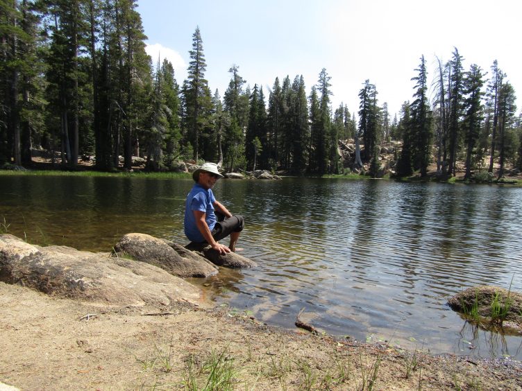
Lily Pad Lake
12.5 miles, Lost Lakes, Blue Lake, Nipple Dome, Lily Pad Lake to Mile 1060
Start: Mile 1073; End: Mile 1060 (Halfmile Maps)
This was our day of reckoning. After our first two easy half days, followed by a nine-mile day we had a 12.5-mile day looming. It looked like water sources were scarce for the next few miles, or that some, such as Lily Pad Lake, didn’t allow camping.
Overall, it was another day of no big elevation changes. We alternated between the typical rocky Eastern Sierra terrain, dotted with a few flowers, and shady forested sections. For all the concern about water, we passed the first of the Lost Lakes within an hour of our start, nestled into trees. There was lots of level ground between the trees and a Forest Service marker but it didn’t look like an official campground. Lost Lakes are the headwaters of West Fork of the Carson River. A few minutes later, we rounded a rocky ridge and spotted the second of the Lost Lakes a short cross-country scramble away. Far below us sat the blue waters of Blue Lakes. We were surrounded by water! Between the forested sections, much of the trail was dramatic, a moonscape dominated by a distinctive feature in the distance, Nipple Dome. The rounded rock formation topped by a much smaller rock can’t be missed.
We crossed the paved Blue Lakes Road, then a creek (note that this is water source #3). The rolling trail continued on to Lily Pad Lake, a wonderfully warm lake that was the perfect lunch spot.
We meandered down some more moderate terrain until we found our campsite next to a creek. There were several private campsites in a large level strip between the trail and the creek, each site screened by trees. We had the place to ourselves until another couple set up camp in the evening.
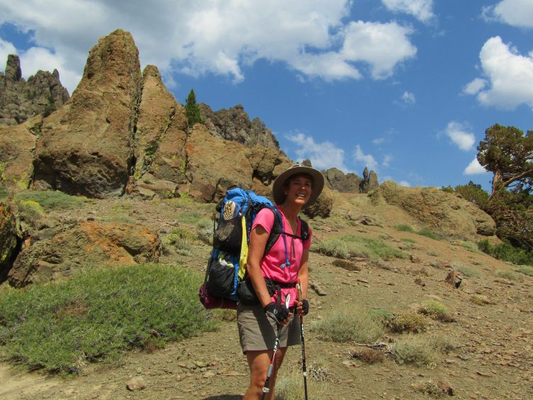
Raymond Meadow
10 miles, between Raymond and Reynolds Peaks, Raymond Meadow to Upper Kinney Lake
Start: Mile 1060; End: Mile 1050 (Halfmile Maps)
We quickly left the level ground behind to begin an extended ascent across dry, loose earth. Some thin sections of trail contoured to follow a canyon felt exposed as a steep slope fell away on the left. Soon the angle lessened and we continued ascending up a broad slope. Two anglers stopped to talk on their way to Raymond Lake on a side trail.
After lunch, we saw many fascinating rock formations, wildflowers in seeps and ancient twisted junipers, the latter accompanied by many fallen juniper berries on the ground.
This 10-mile day felt harder than yesterday’s 13-miler due to the increased amount of uphill. We were anxious to find Kinney Lakes and relieved to see the blue water in the distance. The two man-made lakes are located only a few miles from a road so it’s a popular camping spot for weekenders. The trail is high above the lake and there are rocky cliffs and huge boulders around much of the lake. There are few campsites and most were already occupied. We searched for quite a while, finally locating a large site well above the lake that was near a tiny stream with a trickle of water. We could reach the lake via a steep use trail but it wasn’t very practical.
Noble Canyon just before Noble Lake
9 miles, Ebbets Pass, Noble Lake, Noble Canyon to Asa Lake
Start: Mile 1050; End: Mile 1041 (Halfmile Maps)
We left Kinney Lake and saw more fantastic rock formations. In a short time, we passed Sherrold Lake, a small lake where some hikers like to camp, and crossed Highway 4. We noticed some fragile snow bridges across a few side streams but luckily didn’t have to cross them. Pleasant hiking in the morning transitioned to a steep climb up a big wall just before lunch. The trail narrowed to a thin line and some sections were washed out, likely from the massive rains in the previous winter. It felt a little sketchy, as a fall would have been disastrous. I stepped veeeery carefully. It was a relief to reach Noble Lake for lunch because of the mental concentration required.
Right after lunch, we came to a small snowfield above a small lake. It was a tiny thing at a low angle so I thought this was a good place to do some testing. I was curious to see how easy it would be to kick steps in. I knew we’d eventually hit some snowfields that we wouldn’t be able to avoid. I scrutinized the path in case of a fall, noting that I’d slide into a strip of mud that would keep me from falling in the lake. Steve went up higher and looked secure, but he’s a lot more surefooted than I am in tricky situations. Suddenly his foothold disintegrated in the saturated snow and mud, pitching him forward. He landed on his side and started sliding. I sat down and instinctively grabbed for him, barely catching hold of his pack to stop him. I tried to get up but was ungainly with my pack so I started sliding down. I finally just let myself slide until I could dig my heels in and somehow got up in the mud. We were a wet muddy mess. It just didn’t go that well and I resolved to avoid snowfields whenever possible and hoped the unavoidable ones would be softer.
After transitioning over an unnamed pass, we hiked through a thickly forested section. Below, we spotted Asa Lake, our destination, below us. It had been a reasonable 9-mile day and we looked forward to relaxing by the lake. Unfortunately, it was full of cow patties and the lake was murky but we cleared a spot and enjoyed the setting sun. A clear stream flowed into the lake so we could get fresh water. We heard voices on the trail above us but no one else camped at the lake.
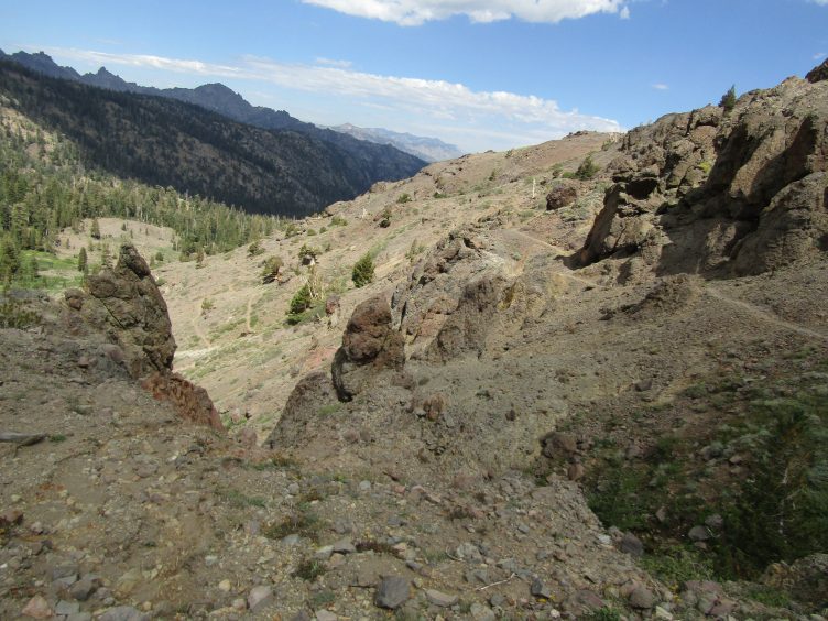
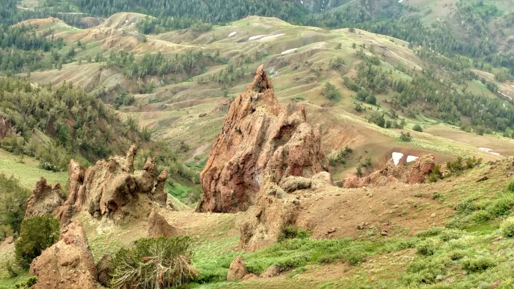
Golden Canyon?
13 miles, Wolf Creek Pass, Murray Canyon, Golden Canyon, White Canyon
Start: Mile 1041; End: Mile 1028 (Halfmile Maps)
When I think about this day, it’s a blur. There were rolling hills and distant views but nothing to anchor it in my memory, other than a lack of water that became all-consuming until the very end.
Hiking out from Asa Lake, the terrain was moderate, punctuated by herds of cattle. We heard the clanking cow bells before we saw them. The rest of the day was uneventful though there were more masses of flowers, more cows, interesting rock formations and snowfields that we didn’t have to cross. It was pleasant enough and easy to get lost in thought. We crossed over Wolf Creek Pass early in the day and entered a basin. For the first time, we could glimpse tantalizingly big peaks to the south.
It was another 13-mile day, which meant that I started flagging during the last hour. There had been no water for miles and I started worrying that next water source had dried up. Our water bottles were empty. We saw a pond of standing black water which actually looked like it would do in an emergency, though Steve was incredulous that I thought so. He was certain that we’d find water where it was supposed to be on the map but I was losing faith. We were traversing uphill on the side of a big canyon. We passed vertical seams where I could see that seasonal streams drained higher snowfields, but they were long gone. Just when I thought all was lost, there was water! And there were several campsites near the creek, occupied by evening by a group of ladies and a solo PCT hiker. The day was saved and Steve was just a little smug.
Sonora Peak
8.5 miles, East Fork Carson River, Sonora Peak to above Wolf Creek Lake
Start: Mile 1028; End: Mile 1020.7 (Halfmile Maps)
We left our precious creek after we waited out a rain squall at breakfast. We knew we had to climb 1500 feet along the East Fork of the Carson River but it was so nicely graded that it felt like hardly any effort. We had a leisurely lunch by the creek. The views back down the canyon were spectacular, with layers of interlacing peaks in the distance. We topped out at 10,500 feet (our highest elevation for this section) over a pass and looked over the other side at Wolf Creek Lake (note that this drains to a Wolf Creek that is different from the day before). Steve wanted to stay there but we never saw an obvious trail. Either we missed it or people just go cross-country to the edge of the lake nearest the pass. The PCT continues to angle higher, away from the lake so by the time we could see the far end of the lake we were high above it. We ended up finding a flat place to sleep on the slope below Sonora Peak next to a rivulet, just enough to provide water. It was a spectacular site nestled under the peak in a clump of small trees and views all the way down to Highway 395. It was a short day, only 8.5 miles but with the elevation gain and our slow pace, it took most of the day.
Wild rock formations on the way down to Sonora Pass Highway
2.4 miles in AM, ¾ mi in PM; camped at 9800 feet, just below Sonora Pass
Start: Mile 1020.7; End: Mile 1017 (Halfmile Maps)
This was to be our nero (nearly zero) day. We were just 2.4 miles from Sonora Pass Highway, where we were going to meet Casey Cox of Sonora Pass Resupply. We had ordered food from his online store and mailed a box of provisions for the second half of our trip. It was raining hard in the morning so we hunkered down in our tent, waiting for it to stop. And waited. And waited some more. For four hours. We ate breakfast in the tent and packed up as much as we could without getting wet. Finally, we decided that it was time to put the rain gear on and break camp, just as the skies cleared and a rainbow appeared over Sonora Peak.
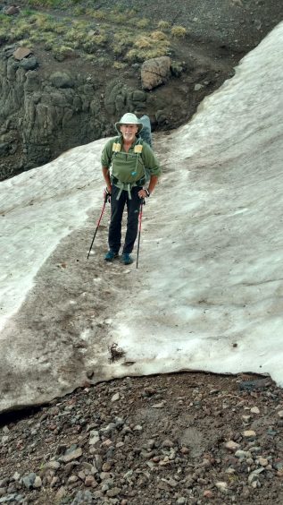
We had to cross a snowfield in the morning, which I hadn’t expected. I knew there were a bunch coming up after Sonora Pass, but I thought I had another free day. The long tongue of snow reached from the top of the ridge all the way to the meadow below. The boot track was flat and soft but the tricky part was getting on and off of it. The gravel leading to it was very unstable and we had to step down a couple of steps to reach the snow and up a couple on the other side. I remembered Steve’s fall on the unstable gravel a few days ago. We stepped carefully and made it across.
When we met Casey at noon, he looked relieved. He was a little worried about us being delayed but assumed the rain held us up. He handed us our mailed box and a box of fresh food we had ordered, pointing to the gas grill where we could prepare our food. He showed us a long strip of outlets and electrical plugs (you need your own USB cord but not the cube with the prongs) and we plugged in our phones to charge.
We spread our wet gear on bushes and chatted with Casey all afternoon while we sorted, packed and ate. Casey had the following supplies: salt, pepper, cooking oil, hot sauce, water bucket, big garbage can, grill, knife, cutting board, paper plates, plastic forks, tongs, spatula, cast iron skillet, and a big bowl. Steve cooked up hash browns, bacon, onion, eggs and sliced fresh tomato. We sat down to a feast.
In the late afternoon, we headed to a campsite Casey had told us about three-quarters of a mile up the trail at the base of Sonora Pass. We wanted to be fresh in the morning for the pass.
***
This section from Echo Lakes to Sonora Pass was, overall, a wonderfully undulating trail. There were some moderate climbs but overall it was less strenuous than I expected. Highlights included the masses of wildflowers, especially in the first half, lakes and dramatic rock formations. Tahoe to Yosemite on the PCT is a beautiful section of the Sierra that shouldn’t be missed.
Our first real snowfield that we had to cross under Sonora Peak
Stephen & Karen says:
Looking forward to this trip. 2x on JMT. This in our backyard has been calling for several years now.
Martinbruff says:
Hi All im newbie here. Good article! Thx! Thx!