


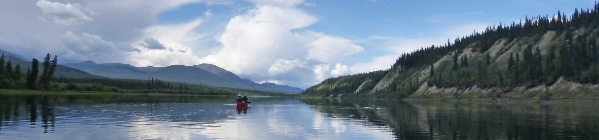
After a restful day hanging out with Casey Cox from Sonora Pass Resupply at the midpoint of our section hike from Tahoe to Yosemite, we were ready to move on to Sonora Pass to Yosemite on the PCT. Please see the previous article, “Tahoe to Sonora Pass,” to learn about the first 76 miles of the trip.
We start this 75-mile section at Sonora Pass on Day 10 of our journey. After Sonora Pass we traverse the crest with the Emigrant Wilderness, Stanislaus National Forest to the west and Humboldt-Toiyabe National Forest, the largest national forest in the contiguous states (63 million acres) to the east.
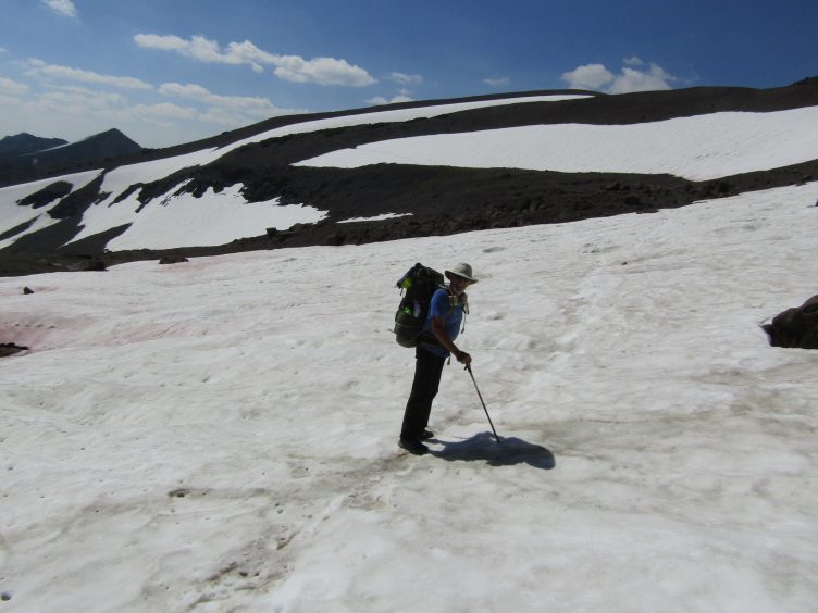
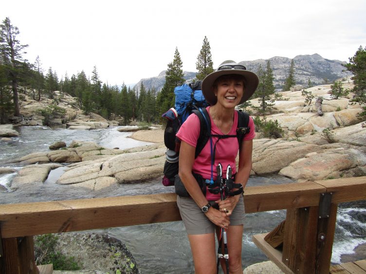
One of many snowfields after Sonora Pass.
10 miles from Sonora Pass to Kennedy Canyon
Start: Mile 1016; End: Mile 1006 (Halfmile Maps)
Like some other passes in the Sierra, it was hard to discern the exact route of the trail from afar. I knew the trail swung from side to side but I wasn’t sure if it exited on the right or left at the top. I could pick out all kinds of difficulties ahead depending on where the trail went. I was anxious to get through the snowfields so we were up early. We loaded up with water as the next 10.4 miles were waterless.
We climbed for a short distance before we reached the first snow chute on the left. It was similar to the one yesterday in that the trickiest part was negotiating the drop from the rocky trail to the soft boot-packed snow and back up the other side. The trail traversed over to the right across another snowfield that was also easy to cross. Whew. I was relieved. I thought there was another big switchback to the left through another snowfield but, to my surprise, we had already climbed the 1200 feet of the ascent. We were up and over a saddle and around the backside in no time. Yay! We missed the third snowfield entirely. The wind was howling so we didn’t tarry long.
The trail stayed high on a ridge with lots of exposure to a steep slope that fell away hundreds of feet above Kennedy Meadows and Kennedy Lake to the right. This is one of the purest “crest” sections of the Pacific CREST Trail. Far in the distance to the west, we could see a large plume of smoke from a forest fire. We crossed a ridge and dropped down a short distance before traversing a small snowfield above a turquoise lake. We ascended toward a jagged ridge, passing through a narrow notch to the next valley. It should have been called the Valley of the Snowfields as we passed over one snowfield after another, some quite large. Sonora Pass had just been the beginning. In all, we crossed eight snowfields that day. The last one was the trickiest as the tongue of snow lapped right up to the far edge of the skinny trail, forcing us to tread ever so carefully on saturated gravel that threatened to give way and catapult us down a steep slope. I was glad to have it behind me. We had a big descent to Kennedy Canyon and I knew we were done with snow for the day.
It had been a unique kind of day, staying high on the ridge the whole time until now. The distant views of granite slabs holding high snowfields were dramatic. But now that we were lower, the flanks of the mountain looked like a gravel pit leading to a strip mine. It was obvious that the devastation in the lower reaches was due to massive winter avalanches. The snow must have ripped down the smooth slope to whip through the forest on multiple occasions leaving piles of broken pick-up sticks behind. We picked our way through short detours and found a miraculously intact bridge over Kennedy Creek. There was plenty of camping up and down the creek so we picked a spot and found our home for the night.
Note: If you like having a traditional guidebook, Yosemite National Park: A Complete Hiker’s Guide by Jeffrey Schaffer (Wilderness Press) provides a good description of this section in reverse in Trip 36, “Tuolumne Meadows to Sonora Pass via Pacific Crest Trail” (see Trips 1 & 4 also). As per my usual, I discovered this after our hike.

Dorothy Lake, Yosemite National Park
9 miles from Kennedy Canyon, Toiyabe National Forest to Dorothy Lake, Yosemite National Park
Start: Mile 1006; End: Mile 996 (Halfmile Maps)
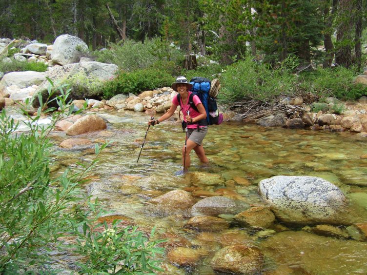
The trail through Kennedy Canyon and Walker Meadows was a pleasant stroll requiring nothing of the concentration required the previous day. We crossed over a roaring creek on a sturdy wooden bridge in the morning. We stopped for lunch at a bend in the creek later that day where the water was placid and enjoyed an idyllic hour in the sun.
After lunch we passed a large set of numbers laid out in stones, spelling out 1,000, presumably marking the 1000-mile mark from the Mexican border on the PCT. Soon after that, we came to a wide, calm creek that was easily forded. A short distance later, the creek seemed to end in a creek so we backtracked a few steps to follow the trail that continued around beautiful Lake Harriet and then Cora Lake. Whoops! It turned out the trail did drop into the water and didn’t go by Cora Lake at all. Back we went for another creek crossing. After a gentle ascent, we passed several other small lakes, ultimately crossing into Yosemite National Park at Dorothy Lake Pass. A short distance beyond the pass was glittering Dorothy Lake, a large, stunning expanse of water inhabited by swarms of hungry mosquitoes. These monsters, the first we encountered, lessened our long-anticipated enjoyment of the lake.

Falls Creek, Yosemite
11 miles from Dorothy Lake through Grace Meadow, Jack Main Canyon, Wilma Lake to Tilden Canyon Creek
Start: Mile 996; End: Mile 985.4 (Halfmile Maps)
The drone of mosquitoes woke us early and we beat a hasty retreat through a very long and very boggy Grace Meadow in Jack Main Canyon as we followed Falls Creek on a barely perceptible descent.
At lunch we stopped at the best spot of the whole hike (for me) at a place where huge, slabby, flat rocks slipped into the creek creating little warm eddies of water. I could have stayed there for a couple of days, wiggling my toes in the small pools. The whole day was one gorgeous swimming hole after another as we followed the creek, ending the day near charming Wilma Lake. Ringed by low rocks on one side it was fringed on the end with reeds and grasses looking like it was created by Disney. Unfortunately, it didn’t look like there were any campsites at this sublime spot though we had passed some ideal spots earlier. We began an ascent, looking for campsites. After passing a dank pond filled with black water, we finally found a campsite. Located among scrubby tamarack with lots of blowdown, the air was smoky and there was no view to speak of. It was disappointing after such a lovely walk. However, little Tilden Canyon Creek was deep enough to submerge ourselves in warm-ish water and we entertained ourselves by watching a couple of frogs frolicking in the pool. The last two days had been pleasant and I spooled up plans to return to this area again. Not so fast though—we still had the washboard section to get through, which is a series of five V-shaped canyons. It would prove to be a daunting barrier.
Rancheria Creek, Kerrick Canyon, Yosemite NP.
10 miles from Tilden Canyon Creek via Rancheria Creek, Kerrick Canyon to Seavey Pass
Start: Mile 985.4; End: Mile 975 (Halfmile Maps)
Blissful days and pleasant strolls were over. This was one long, hard day with 3000 feet of elevation gain and 2000 feet of loss broken into 3 uneven sections. On the John Muir Trail, almost every ascent leads to a long, broad bowl. Here in the washboard section, you ascend up a steep ridge, top out at the pass, plunge down the other side, cross a river that scoured a thin, flat line through the canyon; repeat. Even PCT hikers who were averaging 30 miles a day only planned for 20 miles a day here.
Leaving Tilden Canyon Creek, we labored 550 feet up a steep wall, stopping at the top to admire the view of the next wall, then descended rapidly into Kerrick Canyon. I said a few silent words to honor PCT hiker Chaocui “Tree” Wang, who drowned a month before in the infamous Rancheria Creek. Fortunately, the creek crossing was easy in late August, though it was still up to my knees. We walked along the creek for a short time before beginning another steep, 1,500-foot ascent up to Seavey Pass. There were some beautiful lakes at the pass but a terrific lightning storm drove us on to find better shelter from the exposed granite. We camped under a clump of tall trees by a lake.
View the 25-mile Washboard section on CalTopo. This was drawn free-hand so the mileage may not be exact, but you can get a good idea of the elevation changes. When viewing the CalTopo map, look on the left-side navigation pane and click on the graph icon above “Bulk Ops” to view the elevation profile (click “Expand” for a larger view).

Volunteer Peak
10 Miles from Seavey Pass via Piute Creek, Smedberg Lake, Benson Pass to Wilson Creek
Start: Mile 975; End: Mile 965 (Halfmile Maps)
It was another brutal day with 2600 ft elevation gain and 1100 feet loss.
We descended 1500 feet from Seavey Pass, crossing Piute Creek twice. We had one crossing, then a short walk and another, so it wasn’t worth putting my shoes on in between. This can be another challenging creek crossing with spring melt but it was easy for us in late summer. We saw signs to Benson Lake, which we had heard was worth a visit, but we weren’t willing to walk the extra mile. Piute Creek sits at 7600 feet in this location. From here we will ascend 2500 feet in six miles to Benson Pass. We started the ascent, first at a fairly steep pitch to a series of benches, then extremely steep. I took photos of a Half Dome-like structure way up above us as we labored under Volunteer Peak. Presently I noticed that we were next to the base. Then we were looking over at the top, at the same height! We got to see it from all angles at various elevations with all kinds of different light. We continued up the next hill, finding a high meadow with snowfields hanging above. Continuing to curve north around Volunteer Peak, we eventually reached the shore of Smedberg Lake, where we had a welcome lunch.
We continued our ascent to sandy Benson Pass at 10,100 feet, dotted with whitebark pines. A series of switchbacks took us down to Wilson Creek where we settled into the single large campsite. We passed many potential campsites on the way down along a tributary to Wilson Creek, though all were not ideal in terms of creek access.
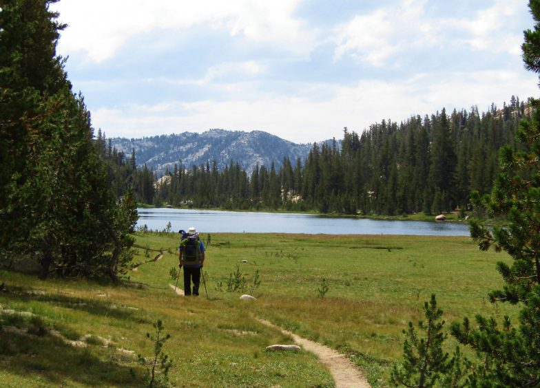
Miller Lake
9 miles from Wilson Creek via Matterhorn Canyon, Miller Lake, Spiller Creek, Virginia Canyon to Return Creek
Start: Mile 965; End: Mile 956 (Halfmile Maps)
After leaving our campsite at Wilson Creek, we continued downhill for several miles, losing 1,000 feet as we followed the creek and transitioned to deeper Matterhorn Canyon. We had a hard 1200-foot uphill on steep switchbacks up the far side of Matterhorn Canyon, but not as long or steep as the last two days. We started to see dramatic peaks to the south that provided an emotional uplift.
The gap that led to a lovely meadow before Miller Lake was welcoming. We had lunch on the sandy shore of pretty Miller Lake. The trail went right next to the lake but it looked like there were good campsites on the other side. We crossed Spiller Creek into Virginia Canyon, dropping 1100 feet t
o Return Creek, which can be difficult in the early season, but was reasonable for us. On the other side of Return Creek were many wonderful, private campsites that could be accessed from a use trail that paralleled the creek. The creek became very narrow and dramatic with strong flows, then widened upstream. It was a wonderful area to explore.
I started calling the washboard section “rim to rim to rim to rim, etc” like the Grand Canyon Rim to Rim hike.
Tuolumne River
14 miles from Return Creek/McCabe Creek via Glen Aulin, Tuolumne River to Tuolumne Meadows
Start: Mile 956; End: Mile 941.4 (Halfmile Maps)
We got dressed and ready to go, shoes on feet, pack on shoulders and immediately confronted McCabe Creek, which joined Return Creek. We were resistant to removing our shoes so early so we made a slightly sketchy crossing. If you stay here, just leave the shoes off to cross the creek. We had a fairly steady ascent through a long, dry section, but it wasn’t bad after the last few days. Each day of the washboard section was slightly easier than the last. We might have hiked longer the day before if there had been reliable water but Return/McCabe Creek was the last water source for several miles. We had 14 miles until the end, which was a lot for us. We debated breaking this day into two but I had a STRONG desire for real food.
I don’t remember anything memorable until Glen Aulin but the hiking was pleasant. Glen Aulin was very pretty with lots of big rock walls, a small waterfall and pool, and a camp. It was the perfect place for lunch. The bridge to the camp was a twisted mess from the rough winter snow and a trail crew was preparing to shut it down the next day to begin repairs. The main bridge across the Tuolumne River was intact, thankfully. After lunch, it was a long haul but undeniably beautiful along the Tuolumne River. We climbed rock stairs, crossed bridges and noted many places that were ideal for serene contemplation for people who weren’t on a mission (for food). On the last stretch before Tuolumne Meadows, we crossed huge smooth rock sections that swooped gently from a point much higher than us all the way to the river. My legs were tired but they propelled me toward the road, our waiting car and the Whoa Nellie Deli in Lee Vining. Ribs! Yum!
Sonora Pass to Yosemite on the PCT is a beautiful section of the Sierra that shouldn’t be missed.
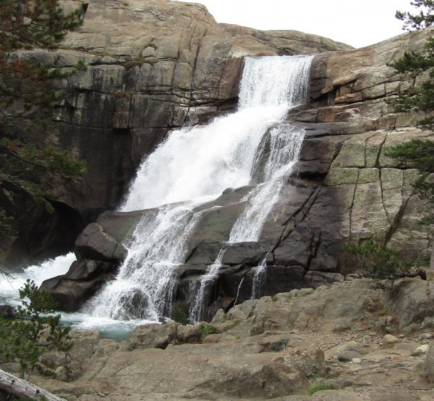
Tuolumne Falls
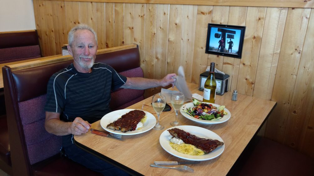
Whoa Nellie Deli at the Mobil Station, Lee Vining.

Wilma Lake, Yosemite National Park
One thought on “Sonora Pass to Yosemite on the PCT: Daily Trip Report”