


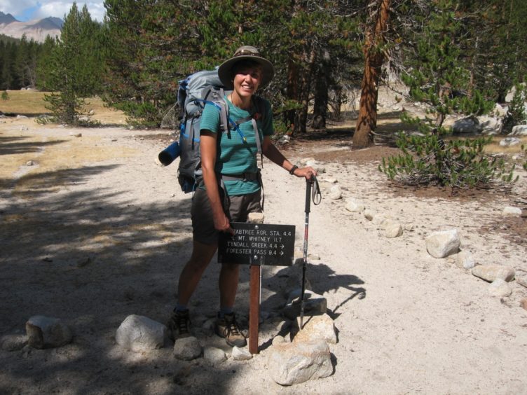
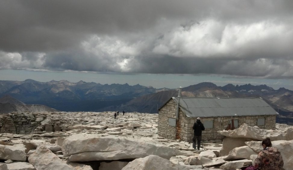
The John Muir Trail (JMT) is a classic trail that covers 211 miles of scenic beauty in the Sierra Nevada mountain range in California. The trail starts at Happy Isles in Yosemite National Park (YNP) and ends on the summit of Mt. Whitney, the tallest mountain in the contiguous United States at 14,500 feet. However, there are no roads to the summit so the trail is effectively 11 miles longer, ending at Whitney Portal. In practical terms, that brings the total to 222 miles. Most of the route is shared with the much longer Pacific Crest Trail. Getting a permit to hike the John Muir Trail can be difficult due to its popularity. This article will help you sort out the options.
All four national parks/forests that access the JMT are use Recreation.gov for permits, though procedures and timing vary. The exit location and camping itinerary are editable. The entry date, trailhead (TH) and alternate leader are not. You must start hiking on the exact date and location printed on your permit. No excpetions. Cancelled permits are released randomlly the same day. There is no specific time.
This was originally published in The Trek.
This trail has exploded in popularity so getting a permit can be a challenge. Planning ahead can be helpful, generally starting about six months in advance. However, last minute permits are available in many locations so if you’re a last-minute kind of planner, that’s a good option. These are relased one week in advance for Yosemite; two weeks in advance for Inyo. In-person, same-day walkups are available in Yosemite and Sequoia Kings Canyon Nationa Park (SEKI) only.
The traditional direction is north-to-south (SOBO) but northbound (NOBO) is also popular. One challenge with going NOBO is that the elevation is significant with a start at 10,000 feet for one of the most popular entrance trailheads. Allowing some time to acclimate prior to the hike is recommended. The biggest passes are in the southern section. For SOBO hiker, it allows time to acclimate and get trail hardened for the most difficult sections. For the NOBO hiker, you can get the hardest parts out of the way first and then cruise to the finish. There are pros and cons to each direction.
The hiking season generally runs from around June through early October with peak season being mid-July through late August. The ideal start date depends heavily on the amount of snow received in the preceding winter so it can vary from early June to mid-July or later. Those hiking in late season should check resupply closing dates, which vary.
While we often speak of a “JMT permit,” there is no such thing. Permits in this region are issued for entry trailheads, not trails. When we talk about a JMT permit, it’s shorthand for a permit to access the JMT. Permits may be issued by a variety of jurisdictions, including National Parks and National Forests, for a large number of trailheads that start on or lead to the JMT. There are two National Parks (actually three but Sequoia and Kings Canyon are operated as one unit) and two National Forests that touch the JMT. Each has its own procedures and rules for obtaining a permit. Information is presented for the four agencies, including Yosemite National Park, Inyo National Forest (INF), Sierra National Forest (SNF) and Sequoia-Kings Canyon National Park (SEKI). Most people will obtain their permit from either Yosemite National Park or Inyo National Forest. Each agency recognizes permits issued by other agencies for travel that crosses national park or national forest boundaries as long as travel remains within wilderness areas.
Permits are required year-round for all the agencies involved. There is a nominal fee for the permit. Some charge an additional fee if you exit Mt. Whitney via Whitney Portal.
Yosemite is the most popular park to start the trail because Happy Isles is the traditional starting trailhead. From 2011 to 2015, Yosemite experienced a 100% increase in applications to hike the JMT. There are a number of restrictions that have been implemented in response to the increased traffic so doing some homework before applying for a permit will pay off.
Permits may be reserved 168 days (24 weeks) in advance from specific trailheads Permits are assigned by lottery. There is a pass-through quota for Donohue Pass (the first big pass you will encounter just before you cross the Yosemite boundary), meaning that only 45 hikers a day may exit the park via Donohue Pass. If you want to hike Half Dome, a popular side trip, you can obtain this when you pick up the permit from specific trailheads.
You will need to note your first night campsite (see below). If you are selected for a permit, you will receive notification by email. You still don’t have a permit; you must submit final payment to confirm the reservation and then you’ll need to pick up the paper permit at a Wilderness Permit Station in Yosemite before your hike.
Inyo National Forest covers a large swath of land that affects the JMT, not because the JMT lies within so much of it, but because Inyo contains so many lateral trails that provide access to the JMT. Highway 395 runs along the eastern edge of the Sierra and provides road access to many trailheads in Inyo National Forest. Unlike Yosemite’s lottery system, Inyo uses Recreation.gov to obtain permits so you can see right away whether there is space. Sound easy? Not so fast. Inyo’s system also has some nuances, so again, it pays to do some research ahead of time so your application process goes smoothly.
Permits may be reserved six months in advance on the matching date (it’s not complicated—if you want a permit on July 15, apply on January 15). Permits drop into the online system at 7 AM Pacific Time and may be taken within seconds for peak season dates. Permits involving entering or exiting via Whitney Portal are not easy to get due to exceedingly high demand. Many people start 20 miles further south at Cottonwood Pass or Cottonwood Lakes (departing from Horseshoe Meadow) to avoid these restrictions. When you apply for your permit, you will be asked to select a non-binding campsite from a dropdown list for each night of your trip. You must enter the first night when you apply, but the rest can be added later. The system will time out if you take too long. Your permit confirmation is not your permit.
Inyo Wilderness Permit Information. Read this to get a head start on Inyo regulations before you apply for a permit.
Permit Application from Recreation.gov. Start with “Explore Available Permits.” For the type of permit, select “Overnight”–this is what most JMT hikers will select. If you want to exit via Whitney Portal, select “Overnight Exiting Whitney.”
Trailheads and Quotas. The number of Inyo trailheads is vast. This chart lists the JMT trailheads and quotas (reservable and walkup). Quota season is from May 1-November 1. Most thru-hikers start at Horseshoe Meadow (10,000 feet elevation), choosing either the Cottonwood Pass or Cottonwood Lakes Trails to avoid having to participate in the Whitney lottery. See below if you want to start or end at Whitney Portal. Thru-hikers may summit Whitney with a regular “Overnight” permit as long as they return to the JMT. If you’re doing a section hike of the JMT, you may start at a wide variety of trailheads so consultation with a map is in order.
Whitney Portal Entry. If you want to start at Whitney Portal, you will need to participate in the Whitney annual lottery or apply online for any spots that might still be available after the lottery. There are no walkups for Whitney Portal but you can make a web reservation up until the day before your hike.
Whitney Portal Exit. If you are starting at another trailhead in Inyo and want to end at Whitney Portal, you will need an additional exit permit. When you apply for an overnight permit through the Recreation.gov link, select the “Overnight Exiting Whitney” permit type instead of “Overnight”. This is a difficult permit to get because of restricted quotas. The “Overnight Exiting Whitney” permit is only required for hikes starting in Inyo; permits from other parks include exiting to Whitney Portal. If you start at any other trailhead in Inyo National Forest, you may summit Whitney from the west with no other permit as long as you return to the JMT/PCT.
Permit Printing Instructions. You must print the permit within a one-week window before your hike starts. There are a few steps to complete, including completing your itinerary in Recreation.gov–click on the link to see the page. You will not receive the permit automatically.
Walkup Permits. Last minute/walkup permits are released two weeks in advance of the hike start date on Recreation.gov. This is also when non-quota permits are released.
Half Dome: If you want to hike Half Dome in Yosemite, you’ll need to apply through Yosemite as if you were a day hiker.
California Campfire Permit: Inyo requires the free, downloadable California Campfire Permit to operate a camping stove.
Call: If you have questions, call the Wilderness Permit Office at 760-873-2483.

Sierra National Forest is located between Yosemite and SEKI, to the west of Inyo. It is only used by hikers approaching from the west, which is not as popular as east-side entrances due to a lack of convenient transportation. The often single lane, winding Kaiser Pass Road leads to Lake Thomas A. Edison where a popular JMT-hiker resupply spot, Vermilion Valley Resort (VVR), is located. VVR operates a shuttle from Fresno to the resort. Muir Trail Ranch, another popular resupply location, is a few miles away. To enter at Sierra National Forest means that you’re accessing the JMT in the middle of the route.
Sierra National Forest issues wilderness permits through Recreation.gov (since 2021). The process is similar to that of Inyo National Forest (see above). There is a quota but permits are easy to get. Sixty percent of permits are reservable and 40% are available as last-minute permits are are released two weeks in advance.
Sierra National Forest Permit Information (Wilderness permits and campfire/stove permit).
Sierra National Forest Permit Application at Recreation.gov.
Trailheads and Quotas. This chart lists the trailheads and quotas (reservable and walkup). Quotas are in place year-round. JMT hikers could use the following trailheads:
Mt. Whitney. Your permit from Sierra National Forest allows to you summit Mt. Whitney and exit via Whitney Portal as long as this is listed as your exit. An extra fee is charged for a Whitney Portal exit.
Permit Pick Up: Pick up the permit from the High Sierra Ranger District office in Prather up to 48 hours before or by 10 am on the day of your hike. The VVR shuttle will stop in Prather.
Walkup Permits: Last minute/walkup permits are released two weeks in advance on the same day of the week on Recreation.gov.
Call: If you have questions, call the High Sierra Ranger District at 559-855-5355.
Nearly half of the JMT goes through Sequoia & Kings Canyon National Parks (SEKI), which are administered together, but the JMT hugs the eastern side of the parks. To approach from the west, there are a couple of options through this rugged part of the Sierra. There are no trailheads to the east of SEKI as a thin strip of Inyo National Forest contains all of the eastern trailheads. This means that permits from the east side are obtained through Inyo National Forest while trailheads on the west are obtained through SEKI in this area.
SEKI issues permits through Recreation.gov (since 2021).
Wilderness permit information from Sequoia and Kings Canyon National Parks.
Permit Application at Recreation.gov. The quota season runs from late May 28 through mid-September. During the non-quota season, self-issue wilderness permits available at visitors centers and not subject to daily entry limits or fee.
Trailheads and Quotas. Links to quota maps are found on the Wilderness permit information page (above). Quota season is late May through mid-September. Most hikers use the High Sierra Trail (Lodgepole area), which starts in Crescent Meadow in Sequoia National Park to join JMT and ends on top of Mt. Whitney. Hikers may elect to head north on the JMT from the High Sierra Trail. Other trails that access the JMT include Woods Creek and Bubbs Creek Trails from Cedar Grove in Kings Canyon National Park.
Wilderness Trail Descriptions. Brief descriptions of the trails are provided but if you follow the link to the High Sierra Trail, you’ll find one of the best planners for this trail.
Permit Pick Up. Your permit confirmation will state where to pick up your permit after 1 pm the day before or no later than 9 am the day of your hike.
Walkup Permits: Last minute/walk-up permits can be obtained in person starting from 1:00pm the day before your trip begins.
Permit Stations. Visitor Centers and Ranger Stations are listed.
Mt. Whitney. Your permit from SEKI allows to you summit Mt. Whitney and exit via Whitney Portal as long as this is listed as your exit.
Call: If you have questions, call the Wilderness Office at 559-565-3766.
There are many trails that access the John Muir Trail and many ways to hike the trail. You may want to hike the trail starting at either end (SOBO for southbound or NOBO for northbound) or complete one section at a time. Some even choose to start in the middle (MOBO), hike north and then return to their beginning and hike south. For the adventurous explorer, there are routes that can be created that parallel the JMT that access equally scenic areas that may be lightly traveled (and less maintained). With some planning and a flexible approach, you can get a permit to hike the John Muir Trail.
For more information, join the John Muir Trail Facebook Group.
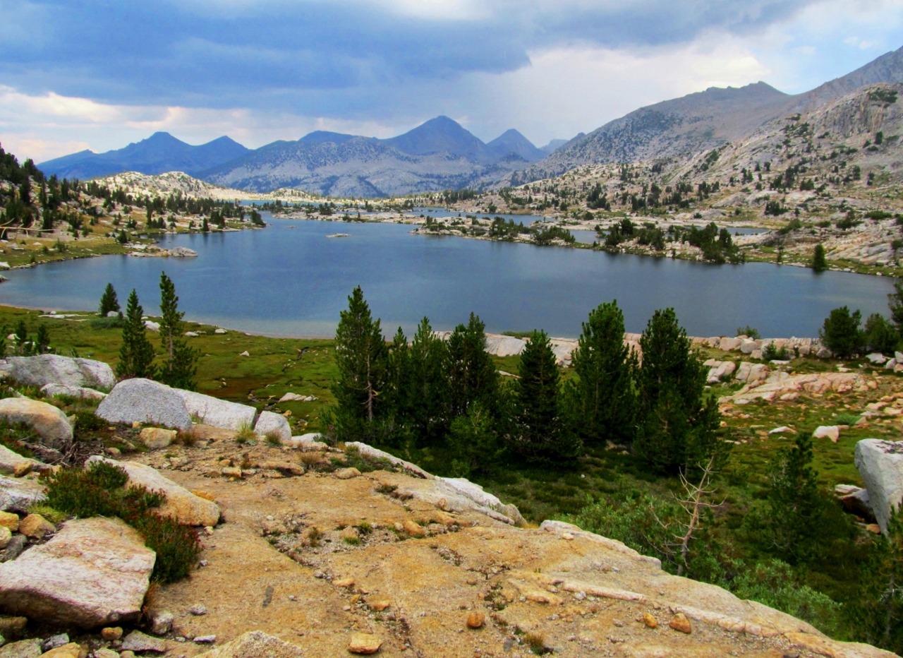
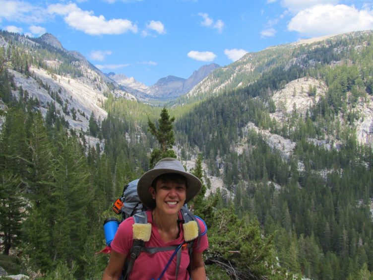
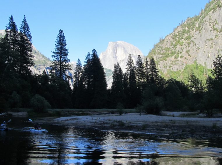
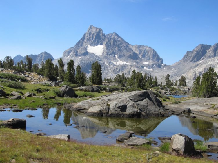
Photos by Inga Aksamit
Robert says:
Thank you for your work in putting all of this together. I have been reading online about walk-up permits, and there is a lot of conflicting information out there. Some people say you have to hop online at 7am 15 days before, and that there is no longer a way to physically walk-up to get a permit. Other people say to show up at 4am the day before your intended start date and stand in line. Can you clarify what the rules are for 2022? Are they the same as you described above? I’m trying to make absolutely sure because of the change over to recreation.org.
Inga says:
Hi Robert, I update my information once or twice a year so my info is current as far as what we know now. Every year there are little tweaks for one agency or another so I will probably update again in the spring as we learn more. As for your question, it is important to be specific about which agency of the four you are referring to as they are all slightly different even though all now use Recreation. gov. For Yosemite, they are planning to go back to in-person walkup permits in 2022 but as with anything in Covid times, that could change. If you’re talking about Inyo, I believe they are planning to maintain the online only “walkup” permits, issued 14 days in advance and they drop at 7 am PT. If you’re talking about SEKI, they only do in person walkups. For Sierra NF, they do them online. Be sure to follow the links I provided for each to double check the info as it can change. Some conflicting information you hear is accurate but not applied to the correct agency; some is outdated if you read blogs that are not updated frequently. I hope that helps.
Heather says:
I have a permit for entry at twin lakes and exit at Mt Whitney it’s for one night two days but i can’t tell if it’s for the JMT and it says it’s not a wild land permit . It’s so confusing . No one will pick up or return emails to answer questions ;-(
Do you know how this permit can be used?