


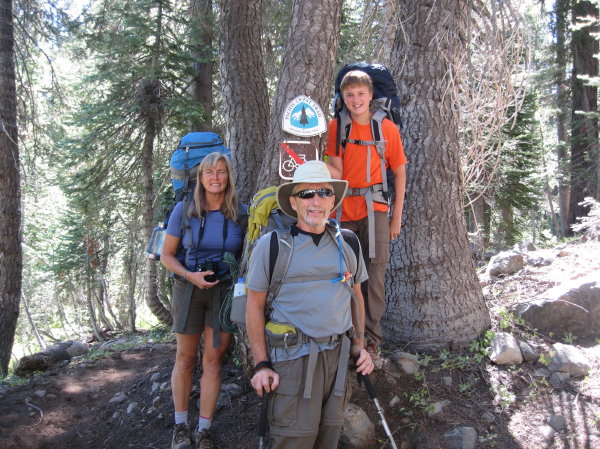
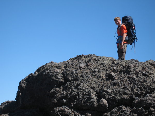
Chase, Inga, Laura, Steve at Castle Pass
The backpacking trip I look forward to each year is not the longest, hardest or most exotic, it’s the one we take in Tahoe with our godson, Chase, and his mom, Laura. We used to be a group of six, but goddaughter Taira, at 16, is focused on water polo, and her dad, Ken, is happy to skip it, so now we’re four, including Steve. Chase, now 14, is getting tall and lanky and carries a good-sized pack. I’ve known other teenaged boys who disappear into themselves for a few years so I wondered how interactive Chase would be this year, but understanding how much he loves the outdoors I hoped he would have a good time even if communication was monosyllabic.
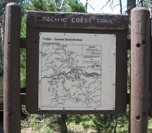
Trail marker at the PCT parking lot at Donner Summit
Steve and I wanted to complete a short, 2-day, 20 mile section of the Pacific Crest Trail (PCT) in Tahoe so we decided to rope Laura and Chase into doing it with us. A couple of summers ago we tried to get to beautiful, diminutive Meadow Lake but were stopped by heavy drifts left over from one of the snowiest winters on record. While tromping around trying to see if we could inch the jeep forward I spied a tiny, triangular, blue PCT marker on a tree. I stood staring at it for a while, trying to wrap my head around the route that crossed this obscure Forest Service road and, glancing over to the other side of the road, spied another marker. This was definitely the PCT. We pulled out the maps at home and discovered that the trailhead was between Webber Lake and Meadow Lake. It looked like a good weekend backpacking route to Paradise Lake, where we had backpacked previously . We resolved to complete this section when we could arrange for two cars so we could leave one at each end of the trail. In the past I preferred to take Chase on trails we had already done so we could minimize our propensity for getting lost but felt like he was getting old enough to take the risk and besides, we had all done the second half of the planned trail together. Not to mention that we had managed to get lost a few times in the past anyway so he’s used to it.
Day 1: Forest Service Road 86 (between Webber and Meadow Lakes) to White Rock Lake (~6 miles)
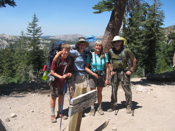
Laura, Steve, Chase at the start. Note the PCT marker on the tree.
We got the cars loaded up one day in early August, dropped one at the PCT parking lot at Donner Summit, stuffed all the packs in the back of the jeep and rolled down Highway 89 North from Truckee, headed toward Sierraville. Even though I had looked at the directions I provide in my Meadow Lake article we got to talking and soon started wondering how far we had gone and where that forest road was. I should follow my own advice and set the trip odometer to measure 17 miles on Highway 89. I stopped to talk to a local guy building something on the side of the road, who pulled out better maps than I had and set us straight. We kept going and eventually found FS07, turned left, and then left again on FS86 to Meadow Lake with all the directional signs we needed. When the elevation started rising on FS86, Chase and I scanned the trees on both sides, searching for the tiny PCT marker high in the trees. “There it is!” we exclaimed at the same time. Soon we were on the trail, nervously looking to the southwest where the Lincoln fire was blazing near Auburn, blowing light smoke our way. “I hope that doesn’t get worse,” I said, hoping for the best.
Chase likes to scramble on rocks
We set off expecting the usual Tahoe trail that immediately ascends without any time to acclimate but were pleasantly surprised and pleased at the gentle terrain. We even had enough breath to talk. We were truly on the crest of the Sierra, coming out onto a bluff that towered over a glaciated valley destined to melt into the grassland of the huge Sierra Valley to the northwest, a high mountain basin that, but for the absence of water, mirrors Lake Tahoe. Looking east, toward heavily forested, interlaced ridges, we wondered where the trail would take us. Heading away from the pastoral vale we kept going, past shrunken streams and dry, brown leaves of Mule’s ears. “That must have been gorgeous in the spring, with all the yellow flowers dancing in the sun,” I remarked. The trail led through a forest thick with western white pine and red fir as we continuing our ascent. Suddenly Chase threw down his pack. “Oh, look how beautiful. MOM, I need the camera right now!” he cried as we reached another ridge, this one facing southwest. Laura slipped the strap from her neck to give him the camera and he scampered around finding the best angle to photograph the vast, panoramic Sierra sprawling before us, despite the haze cloaking the distant peaks. This was not the silent teenager I was prepared for, this was the bubbly, personable Chase he always was, just in a taller body.
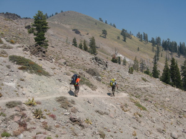
Chase and Steve on an open slope
“Let me take your picture,” I said. “OK” he replied, but I noticed that he quickly removed his sunglasses and took a swipe at his hair. That’s cute, I thought. He’s starting to care about how he looks. As he posed I snapped the picture, thinking that I’d better be careful about what photos I post on Facebook. Our meandering route took us roughly east-southeast from the FS86 road toward White Rock Lake. I had a map from Schaffer guidebook and had plotted a route from the Topo software but there was a discrepancy. The Topo program (now defunct; I use CalTopo instead) appeared to show an old, temporary PCT route that isn’t in alignment with the current route so I had to freehand it from the one in the book. The first half of this hike, all the way to Paradise Lake, is in a logging area, one of my least favorite areas to hike in, not so much because of the slash piles and cuts but because logging areas always have a maze of intersecting roads that make it very easy to get lost. Luckily it was pretty easy to tell where the main trail was and key intersections were signed. I’m at a stage in my backpacking where I prefer the joy of freely walking to the tedium of route-finding so I appreciate all the volunteers out there maintaining trails.
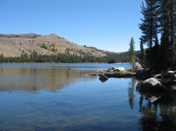
White Rock Lake (photo: Chase Hovden)
We turned off the PCT at a well-marked junction with a sign to the Mt. Lola Trail that we followed, which parallels White Rock Creek, rather than the TOPO route going to the east shore of White Rock Lake. After ascending moderately steep terrain we came to the dam at the end of large White Rock Lake. Taking a right, to the east side of the lake, we avoided campers accessing the lake from the jeep road. We did see one party camped on that side. A small, sandy beach with some good campsites along a section of smooth rocks looked like home for the night. After pitching our tents and setting up camp we noticed that the wind had kicked up quite a bit. After scouting around I found a better campsite a little further down, near some prominent rocks just before a little cove. “I found a better campsite,” I announced to Steve, Chase and Laura.
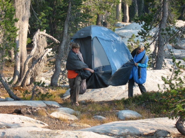
Chase and Laura change neighborhoods
“What’s better about it?” asked Steve.
“Less wind,” I said. “What are we going to do, break down camp and start over?” Steve asked.
“Couldn’t we just pick up the tents and move them?” I asked. Steve didn’t look interested.
“Chase, do you want to check it out with me? I asked, knowing that he hates wind, ever since he was a Mighty Mite at Squaw when the wind would whip sharp specks of ice into his tender 4 year old face. If I could build a base of support we might be able to convince everyone to move.
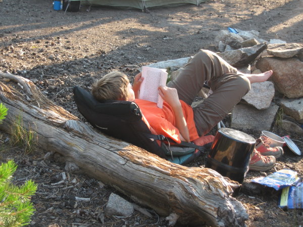
Chase relaxes in his two camp chairs
“Sure,” he said. We clambered over the smooth granite and I showed him the spacious campsites protected by a wall of rock.
“See how calm it is here, and we can still get water right over here,” I said.
“This is way better. We should move,” said Chase definitively. We ran back to the others.
“Chase agrees that it’s a much better neighborhood,” I said.
“Yeah, it’s ghetto over here,” said Chase, “much better in the nicer neighborhood.”
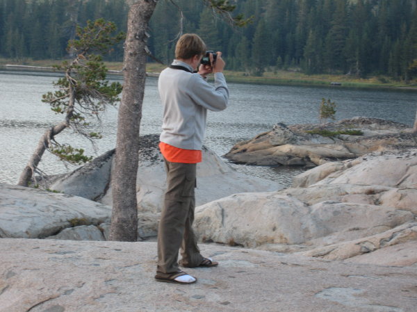
Chase, the photographer
Steve looked quizzical but I talked him into seeing if we could just unpeg our diminutive tent and carry it over, lock, stock and barrel. It worked! Chase and I scurried to make multiple trips to bring everything over and a half an hour later we were all set up in better digs. Somehow, we ended up with a multitude of camp chairs, which I shun as being too heavy. Chase sprawled out on two chairs and read “Into Thin Air”, about a disastrous summit attempt on Mt. Everest, a perfect adventure story to read on the trail. We soaked our feet in the relatively warm lake water and relaxed in the late afternoon, snacking on string cheese and apples. For dinner we cooked up some delicious freeze dried Asian food and sipped on Pinot Noir that Steve brought in a Nalgene bottle. Steve had his wood-burning stove, and Chase has always loved fire, so he helped gather the small sticks that are needed to feed the hungry stove. Chase is showing quite some talent and aptitude for photography, spending time composing great shots to capture our experiences. It was fun to see how he’s growing and evolving, conversing easily in adult conversation. We shared ideas for how to get the brilliant moon in focus, to Chase’s delight.
We woke to clear, brilliant blue skies ……..
See Part 2 of “Backpacking Webber Lake to Donner Summit on the PCT”
Information The guidebook listed below describes this hike in detail. The AAA Sierra Nevada-Lake Tahoe Area map is a good resource for Meadow Lake and the surrounding area, available at Amazon.
Permits Permits are not required for overnight visits in this area. However, California Campfire Permits are required if using a portable campstove for cooking or building a wood fire. Permits and information about current fire restrictions are available from any Ranger Station or California Dept. of Forestry office. Permits are available online at PreventWildfireCA.org after completing a short, 4-question quiz.
Forest Service Ranger Station in Truckee: 10811 Stockrest Spring Rd, Truckee, CA 96161
Getting There Start: To reach the trailhead near Meadow Lake from Truckee, CA (near Webber Lake):
Finish: To reach the Pacific Crest Trail parking lot near Boreal Mountain Resort from Truckee, CA (near Webber Lake):
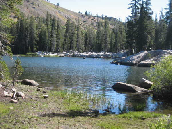
White Rock Lake
Photos by Inga Aksamit
[set_id=72157635707208466]
5 thoughts on “Backpacking Webber Lake to Donner Summit on the PCT-Part 1”