


If you’re wondering how to get to Chachapoyas and the ruins of Kuélap Fortress, this guide covers what I learned the hard way.
A spine of the Andes in northern Peru was a place I had long wanted to see. After living in the country for two years as a kid and visiting four different regions with my husband, I had already covered a lot. Past trips included Lima, the Forgotten North Coast (Trujillo, Piura and Mancora), the central Andes (Cajamarca and wilderness backpacking around Huaraz), and the classic Gringo Trail (Cusco, Machu Picchu, Lake Titicaca, Puno). Two areas were missing: the northern Andes and the Amazon. Our most recent trip included these two disparate areas, though I learned that the connection between these regions are strong.
You will be able to read more about the trip when I post the next article about the sights we saw and activities we participated in. Because I found the logistics so challenging for this trip, I’m going to focus this article on what I learned in case other travelers have the same idea.
My basic framework was eight days in July to cover the area around Chachapoyas in the northern Andes (nine days including the day of travel from the US). After that, I planned to travel to the Amazon for a 3-night excursion on the river, which I’ll cover in a separate article.
| Topic | Details |
| Trip length | 8 days in the region, plus a travel day from the US to Lima |
| Route | Fly into Tarapoto, drive south through the Andes, fly out of Cajamarca |
| Getting around | Private car and driver from Turismo Explorer, Chachapoyas |
| Best season | Dry season, May–September (we went in mid-July) |
| Highlights | Gocta Falls, Chachapoyas, Kuélap Fortress, Leimebamba Museum, Marañón canyon, Cajamarca |
| Highest point | 11,800 ft (Leimebamba–Cajamarca road) |
Our goals for the Chachapoyas area included seeing the Kuelap Fortress, Gocta Falls, the town of Chachapoyas and the mummies at Leimebamba.
Our travel group comprised me, Steve (my husband), and Carina (a good friend). Like me, Carina lived part of her early childhood in Peru. She was born in Lima and lived there until she was seven, hearing stories from her grandparents about a fabled family hacienda in Northern Peru. To our list of goals, we added a quest to find the ancestral home.
After sketching out a plan for what we wanted to see, I started looking into flights and immediately realized that flexibility was going to be critical. Getting to Lima from San Francisco via Houston was easy. Getting from Lima to the northern reaches of the Andes was another story. None of the airport choices is ideal.
Airport status as of October 2026. Check before booking.
| Airport | Drive to Chachapoyas | Reliability | Our verdict |
| Chachapoyas (CHH) | — | One airline (ATSA), small turboprops, once daily. Frequent fog cancellations; travelers report 1–3 day delays | Too risky for a tight schedule |
| Jaén (JAE) | 5 hours | Open intermittently since 2022 because of runway damage. Mostly closed in 2026 (emergency and humanitarian flights only). Google Flights may substitute Chiclayo (CIX) instead | Don’t count on it for 2026 or 2027 |
| Chiclayo (CIX) | 10 hours | Reliable; large coastal airport with frequent flights from Lima | A workable backup, but the longest drive |
| Tarapoto (TPP) | 7 hours | Reliable; lowland airport on the edge of the Amazon | Our arrival airport (we broke up the drive with a night in Moyobamba) |
| Cajamarca (CJA) | 10 hours | Reliable; long, rough high-altitude road | Our departure airport, with Leimebamba and Kuélap along the way |
Gradually, an idea for an audacious road trip formed. Instead of having to backtrack for hours at the end of the trip, why not fly into one reliable airport and out another? After proposing this plan to my travel companions, we debated pros and cons of potential travel fatigue vs the best opportunity to see the most we could see in a week. We went for it.
The plan we settled on was to fly from Lima to Tarapoto, make our way over to Chachapoyas and meander south on Highway PE-8B (also known as Highway 088). We would travel on the crest of the Andes, eventually ending up in Cajamarca. From Cajamarca, we would fly to Lima and continue our trip. It meant a lot of driving nearly every day, but the thought of understanding how everything linked together excited me. We decided to get a car and driver to make the driver easier.
| Day | Route | Travel time | Overnight | Main sights |
| 1 | San Francisco → Houston → Lima | Full day | Lima (airport hotel) | — |
| 2 | Lima → Tarapoto (fly), Tarapoto → Moyobamba (drive) | 85-min flight + 2.5-hr drive | Moyobamba | Plaza de Armas |
| 3 | Moyobamba → Cocachimba | 5-hr drive | Cocachimba | View of Gocta Falls |
| 4 | Cocachimba | — | Cocachimba | Gocta Falls hike |
| 5 | Cocachimba → Chachapoyas | 1-hr drive | Chachapoyas | Chachapoyas town |
| 6 | Open day in Chachapoyas | Optional | Chachapoyas | We used it to find the family hacienda near Tingo (4-hr round trip) |
| 7 | Chachapoyas → Kuélap → Leimebamba | 2-hr + 2-hr drive | Leimebamba | Kuélap Fortress, Leimebamba Museum |
| 8 | Leimebamba → Celendín → Cajamarca | 8-hr drive | Cajamarca | Marañón River canyon, Celendín |
| 9 | Cajamarca | — | Cajamarca | Cumbemayo, Otuzco |
| 10 | Cajamarca → Lima | 80-min flight | — | On to the Amazon |
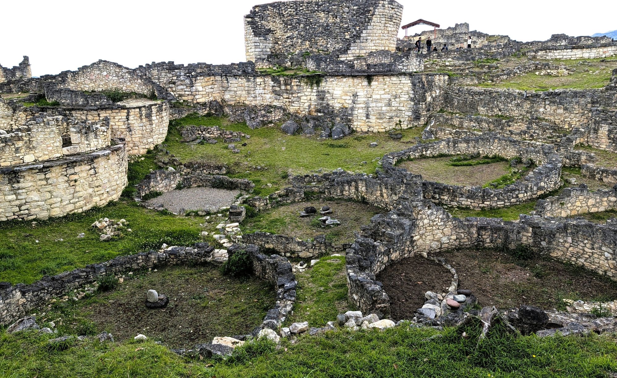
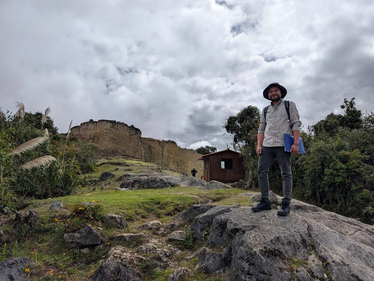
Kuélap Fortress: It’s best to get tickets in advance through the Tu Boleto Cultura website for 30 soles (around US $8.50 per foreign visitor. The professional guide at Kuelap Fortress cost 50 soles (US $14.75).Vehicles can drive to a base parking lot in Tingo, where tickets are checked. From there a bus takes visitors to the cable car (20-minutes each way on the cable car). Allow four or five hours to visit the fortress and be prepared for lots of walking at high altitude (9,800 feet). My Fitbit recorded 10,000 steps on the excursion.
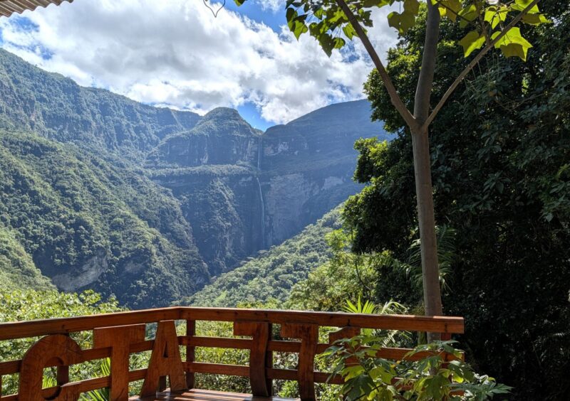
Gocta Falls: The main trail from Cocachimba to the base of the falls is 6.8 miles round trip. Hikers can walk to the trail from any hotel in town. The dirt path is wide and well maintained. We were a little short of breath at 5,900-foot and we felt the heat and humidity. We obtained a permit from the Cocachimba Tourist Office (Oficina de Turismo de Cocachimba) for 15 soles (less than US $5). You can also get them at a trail kiosk when it is manned. The trail is maintained by the community, and the fee goes toward costs associated with maintenance. There is no need for a guide, but you can hire a guide or a mule. If you’re staying in Cocachimba or Chachapoyas, ask at your hotel for assistance with planning.
Leimebamba Museum: A must-see stop, even if you’re not staying in Leimebamba. It’s open from 10 AM-4:30 PM (hours are flexible and we were able to get in at 5 PM). We spent about an hour in the small museum, the mummies being the most fascinating. Entry fee was 15 soles (less than US $5). Consider making an extra donation for this community-run treasure.
Cumbemayo and Otuzco: There are a few archeological sites around Cajamarca and one that we enjoyed was Cumbemayo, a pre-Inca canal system with petroglyphs and volcanic pillars. Another was Otuzco, an ancient necropolis where people were buried in stone niches. Any tourist kiosk at the Plaza Mayor offers daily group tours, or private guides are available, or you can go on your own via taxi. We had a private guide that was bundled with an extra day with our car and driver but was probably around US $35.
The rainy season is from October through April. It can rain at any time in the cloud forest, but less in the dry season. I prefer the dry season when it’s easier to plan outdoor activities and is safer on the mountain roads. I always pack a raincoat and a packable puffy for chilly weather at higher elevations.
On our mid-July trip, we were lucky to have wonderful weather, with only a few sprinkles here and there on our road trip.
Unlike the well-trodden Gringo Trail to Cusco and Machu Picchu, this is not an area visited by many international visitors. I had a hard time finding reviews for guides and drivers.
I contacted a guide, Carmen, who I used in Trujillo via Tours by Locals and she recommended José Llaja (Whatsapp +51 975 819 867). Every time I contacted him, he responded right away.
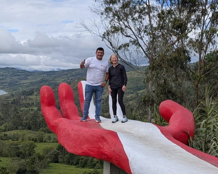
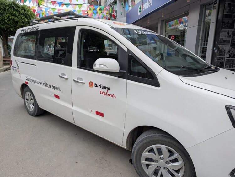
José runs the Turismo Explorer Travel Agency in Chachapoyas, employs eight drivers, and has a fleet of vehicles. He found us local guides when needed. Our driver, Bryam, picked us up promptly from the Tarapoto airport, expertly navigated challenging road conditions and made us feel safe. The comfortable mini-van was spotless inside and out every morning and featured air-conditioning and functioning seat belts.
We paid for lunches for Bryam and guides separately, usually around US $5 per person.
José also owns the popular Chachapoyas Backpackers Hostel in Chachapoyas, which turned out to be one of the best places we stayed on the trip.
See Typical Costs below for what we paid.
These days, you can get by without speaking the language by using Google Translate, but Carina enhanced our trip with her fluent Spanish. Even a little Spanish (my basic level) will go a long way in this area where most tourists are Peruvian.
There are ATMs in the larger towns such as Tarapoto and Chachapoyas, but not in the smaller villages. Breaking large bills was also difficult at times. Some hotels took credit cards. Others only took cash. Come prepared with Peruvian Soles in small bills.
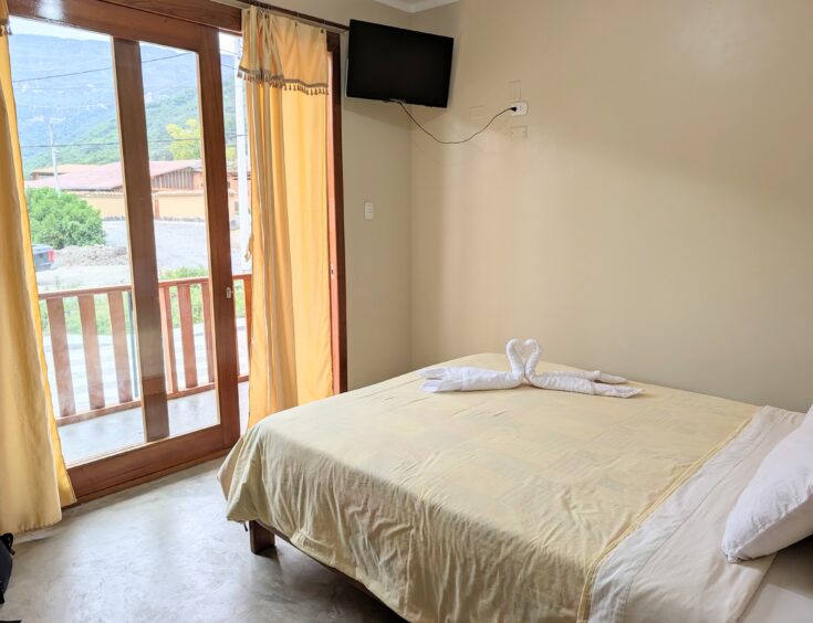
There were no international chain hotels in the area of the road trip, and the only Wyndham Costa del Sol (a Peruvian brand that partners with Wyndham) was in Cajamarca. We stayed in small, mid-range hotels with private bathrooms. We scrutinized reviews on Booking.com and Trip Advisor and adjusted our itinerary if we couldn’t find lodging. Reservations were made on the hotel website or through Booking.com. Deposits were made by bank transfer as noted.
Our biggest expense was the car and driver. The bundled cost for seven days was 5,350 soles (US $1,540) and included car, driver, fuel, driver lodging when needed—there were no additional charges related to transportation.
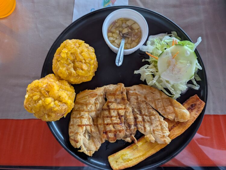
In general, the cost of food and lodging was extremely low. We used the SplitWise app to track shared expenses. A couple of meals were $60 for three people with wine. Most lunches were around $5-7 per person for lunches that were so substantial that most nights we skipped dinner or had a banana and crackers or delicious fresh yogurt and fruit.
The small hotels on the road trip ranged from $40-$115 per room per night. The most expensive hotel was the Wyndham Grand Costa del Sol Hotel at Lima Airport at $160 per night.
2026 prices. US dollar amounts are approximate.
| Item | Cost |
| Car and driver (7 days, including fuel and driver’s lodging) | 5,350 soles (about $1,540) total for 3 people |
| Driver and guide lunches | Under $5 per person; we paid these on top of the driver fee |
| Flight, Lima–Tarapoto (LATAM) | $147 per person |
| Flight, Cajamarca–Lima | $114 per person |
| Small hotels on the road trip | $40–115 per room per night |
| Lima airport hotel (Wyndham Grand Costa del Sol) | $160 per night |
| Lunches | $5–7 per person |
| Nicer dinners with wine | About $60 for 3 people |
| Kuélap entry | 30 soles (about $8.50) per person |
| Kuélap professional guide | 50 soles (about $14.75) |
| Gocta Falls trail permit | 15 soles (under $5) per person |
| Leimebamba Museum entry | 15 soles (under $5) per person |
| Private guide, Cumbemayo and Otuzco | About $35 |
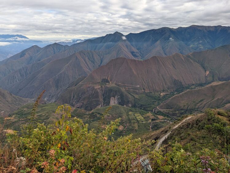
Tarapoto and Moyobamba are low elevation (less than 3,000 feet), but after that, we climbed to nearly 6000 feet in Cocachimba and 7,661 feet in Chachapoyas, enough that we felt a little short of breath when hiking or climbing stairs. The Kuelap Fortress was quite high at 9,843 feet and involved a lot of walking. The highest point after that was 11,800 feet on the drive between Leimebamba and Cajamarca, and the Cumbemayo archeological site near Cajamarca was 11,400 feet.
We are all high-altitude skiers and hikers so we were prepared, but if you’re not used to altitude or don’t know how you’ll react, it’s best to take precautions. As an RN who suffers from altitude sickness, I have researched this topic extensively and co-authored An Unofficial Acclimatization Guideline: Your High-Altitude Guideline for the John Muir Trail.
If you’re interested in more information, please join my science-based Altitude Acclimatization group on Facebook.
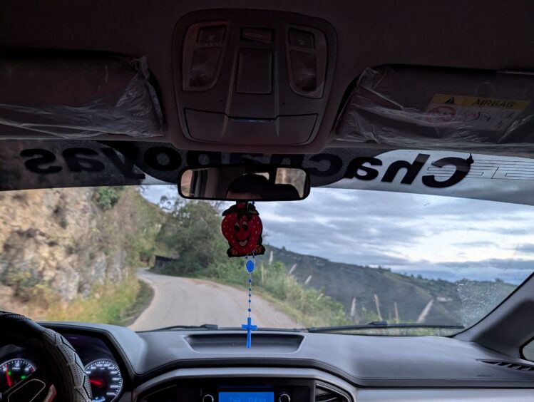
The road from Tarapoto to Moyobamba was in good shape. After that, the roads were not as well maintained with many potholes. When estimating drive times, don’t base it on what you can drive on the average US freeway. Even Google Maps tended to underestimate drive times between towns by 1-2 hours.
One section of the road that is notorious is the 8-hour segment between Leimebamba and Cajamarca. It’s narrow, winding, potholed road with no guardrails on a precipitously steep, high-altitude route that left us gasping as we peered 9,000 feet down the mountain the river below. I thought traveler reports were exaggerated. They are not.
Planning this trip took more digging than most, but every hour on those mountain roads was worth it. Northern Peru rewards travelers willing to trade convenience for cloud forests, cliffside fortresses and a landscape few outsiders see. In my next article, coming soon, I’ll take you along the route itself, from the thunder of Gocta Falls to the mummies of Leimebamba and the search for a long-lost family hacienda.
Read more about my Peru travels in a series of articles in the Peru section of Inga’s Adventures.
 Previous Post