


Hiking in Japan is a trekker’s dream destination since three-quarters of the island nation is mountainous. They have a rich hiking culture with extensive networks of huts and village to support short day hikes or longer multi-day hikes. Trails are well maintained, and hikes can range from coastal hikes with expansive water views to remote alpine hikes or historic hikes on ancient samurai trails.
The four hikes in Japan presented here are ideal for casual day hikes that could easily fit a tourist itinerary. All have extensions that might tempt you to do longer hikes. Three hikes are on the main island of Honshu between Tokyo and Hiroshima and one hike is on the northern island of Hokkaido. Hiking in Japan was a highlight of a three-week trip to Japan in late September-early October when the seasons were changing.
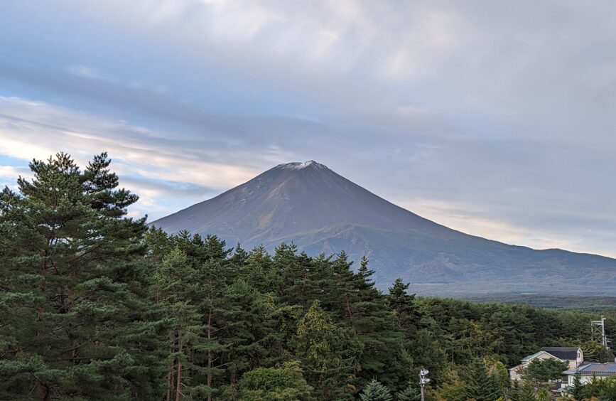
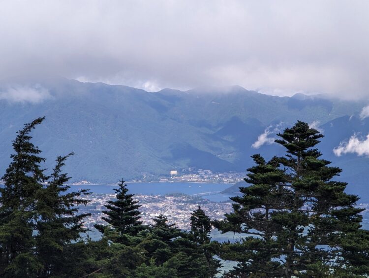
This iconic mountain that rises to 12,388 feet features prominently in Japanese culture. It is a sacred place that dominates the landscape for miles around and has drawn pilgrims to worship its flanks since ancient times. With five million tourists a year, one might think the trails would be crowded with hikers, and sometimes they are. However, many tourists travel by bus to the Fifth Station at mid-mountain, at an abrupt transition zone between thick forest and bare volcanic rock, and go no further.
What made our hike on Mt. Fuji special was the solitude when we did the opposite of most hikers. Instead of climbing to the top, which was closed for the season, we hiked down from Fifth Station to the base of the mountain on the Yoshida Trail. We didn’t pass a single other hiker on our descent. Unexpected links to the past were a big draw, along with the quiet beauty of the forest. There were shrines, historic hiker huts that used to house pilgrims before the road was constructed, dappled sunlight in the forest and peek-a-boo views of Lake Kawguchico.
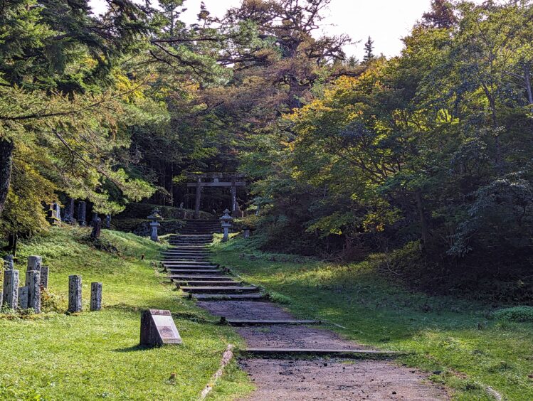
A large torii gate at a shrine known as the Kitaguchi Hongu Fuji Sengen-jinja Shine graced the grand entrance at the base. We discovered a lone gentleman manning a small snack kiosk. With sign language and limited language, we understood all too clearly when he said, “two more hours” and used two fingers to mime walking to reach Lake Kawaguchiko. During the summer season, there is a shuttle from Station One to Lake Kawaguchiko. If the bus isn’t running, hikers can call a taxi if they have cell service or arrange for a ride before they set out. There was no bus, and we had no cell service, so we walked and walked. Eventually, a group of Japanese men inquired about our destination and kindly offered a ride.
Summer hikers may hike to the top of Mt Fuji from the First or Fifth Stations. There are huts in the upper section for overnight stays.
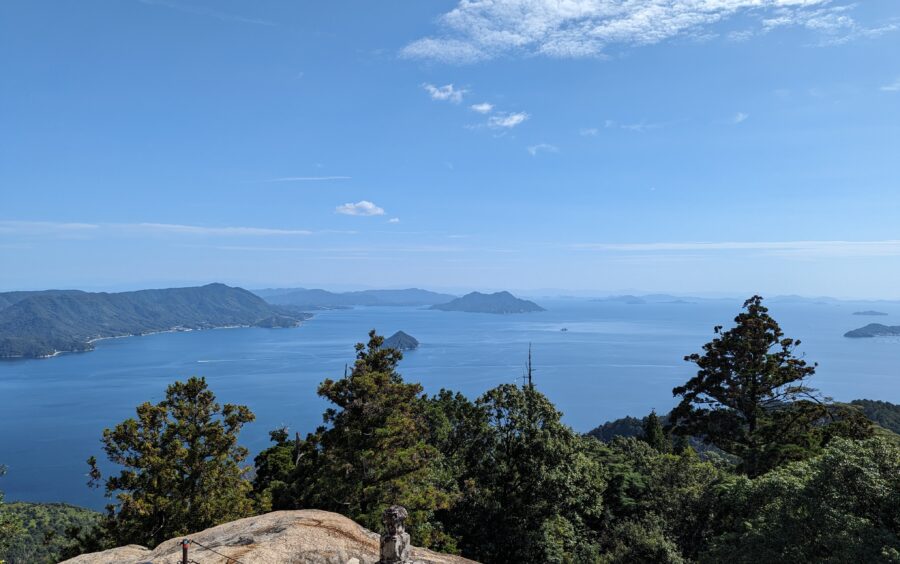
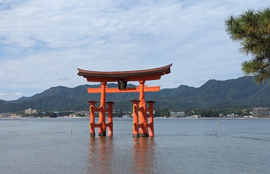
Miyajima Island (Shrine Island), officially known as Itsukushima, is a short ferry ride from Hiroshima. The famous red floating Shinto torii gate and Itsukushima-jinja shrine is a UNESCO World Heritage Site, but there are many Buddhist temples as well. What is less appreciated is the network of hiking trails that provide spectacular 360-degree views of Hiroshima Bay and Onoseto Straight.
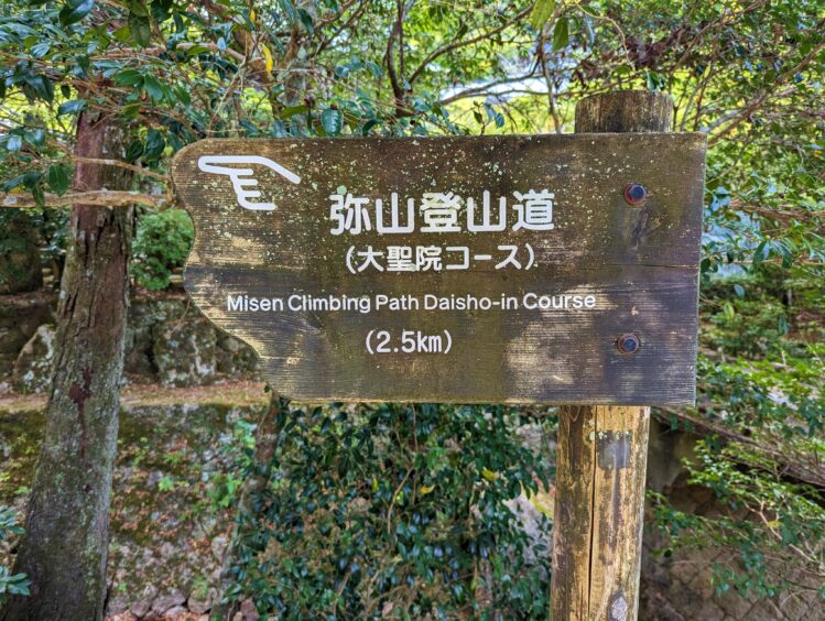
The stats belie the effort needed to hike to the top of Mt. Misen on the Daisho-In Course. A hike of just 1.72 miles would be short stroll on a level track, but when an elevation gain of 1,694 feet is added, it’s an excellent workout for the day.
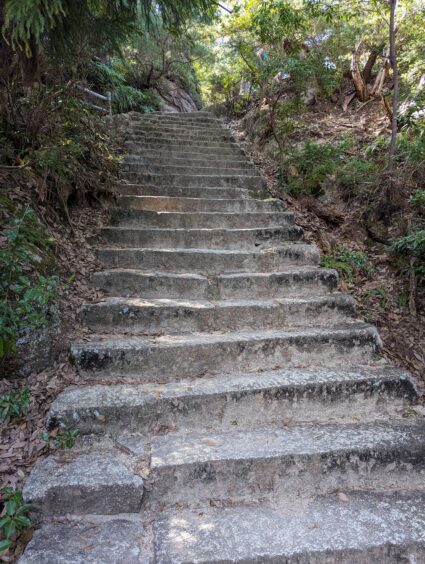
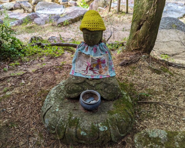
Starting from the Daisho-in Temple, the path was described as having some stairs. This turned out to be 2,000 stone steps. As steep as it was, this was the gentlest option of the three trails to the top of Mt. Misen. The views of the Onoseto Straight became more dramatic the higher we went, spurring us up the trail. Most of the path up to an observatory was shaded, providing some relief from the heat and humidity. I admired each of the many Buddhist statues, some adorned with knitted caps and cotton wraps, others housed in formal structures. The reward at the top was a 360-degree view the Seto Inland Sea, Hiroshima Bay, and other islands.
We took a ferry from Hiroshima Peace Memorial Park in Hiroshima to Miyajima and back.
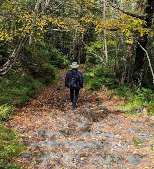
The Nakasendo Trail is one of five ancient Gokaido trails developed in the 8th century to connect Tokyo (then called Edo) to Kyoto and other towns. In the 17th and 18th centuries, the Nakasendo got heavy use from Tokyo-based Shogun rulers who traveled with a retinue of samurai warriors, giving rise to the name “Samurai Trail.” The Nakasendo Trail is a multi-day trail with 69 stations, or rest stops, along 332 miles.
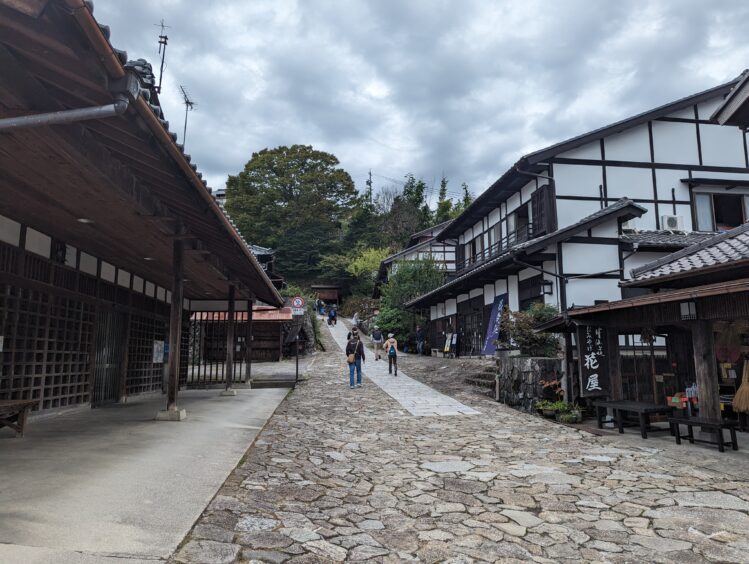
The four-mile section between Magome and Tsumago is particularly suited to visitors who want a small taste of the trail, as it is a relatively gentle section that is well served by public transportation. These two towns are known as post towns from the samurai days when their luggage was posted ahead of their arrival. Even now, there is even a baggage-forwarding service for this section. We hiked one more station to Nagiso, where there was a train station.
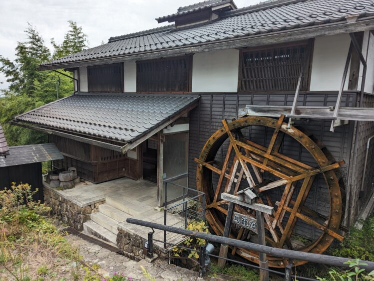
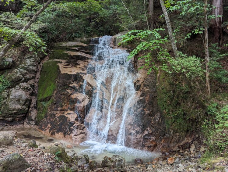
The unique aspect of this trail is the glimpse of old Japan. There are no tall buildings or busy roads. The trail winds through the Kiso Valley, passing traditional low houses, waterfalls, wooded areas and open fields. Much of the trail is cobblestone but there are also sections of paved roads and dirt trails. Along the trail are vertical pillars with bells that hikers are encouraged to ring to deter bears. Both Magome and Tsumago have the authentic feel of an old post town with wooden houses, waterwheels, small restaurants and family-run inns where multi-day hikers can stay. A charming tea house in an unpopulated area offered a place to rest and tea for a small donation.
We stayed in Nagoya and took a train to Nakatsugawa Station on the Nagano line and a bus to Magome at the beginning of the trek. The bus was waiting in front of the train station when we arrived. After hiking to Nagiso, we took a train back to Nagoya, which involved one transfer. I used the Rome2Rio app to plan transportation.
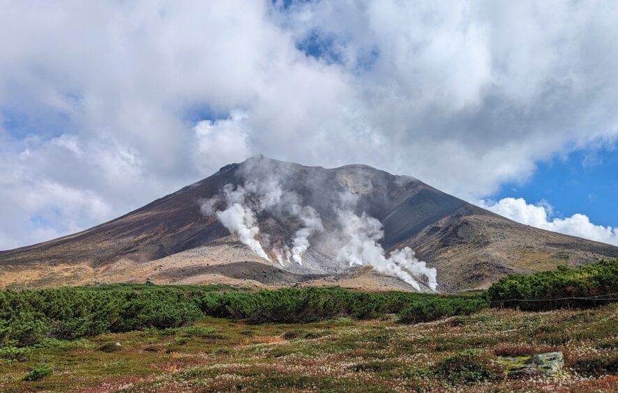
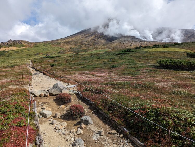
The otherworldly scene spread before me in Daisetsuzan National Park in Hokkaido, Japan took my breath away. The hissing fumaroles spewing vertical plumes of sulfuric steam contrasted with the calm Sugatami reflecting ponds mirroring puffy white clouds, all framed against the towering massif of Asahidake Peak rising to 7,516 feet. Low, earth-hugging plants and late wildflowers carpeted the rocky slopes above tree line and enticing trails beckoned me to explore more.
Daisetsuzan National Park in Hokkaido is loaded with trails across 875 square miles and holds 16 peaks over 6,600 feet. The scenery is rugged and natural in the largest national park in Japan.
We did several day hikes around the town of Asahidake Onsen, one of several places inside the park with a cluster of intersecting trails and lodging. Most visitors hike the one-mile Sugatami Pond Loop at the top of the ropeway, which is a beautiful introduction to the area with the fumaroles and ponds front and center.
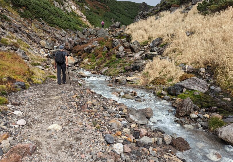
Wanting a longer hike, we departed from the Sugatami Pond Loop to head toward Nakadate Onsen. The special part of this six-mile out-and-back trek was the natural Nakadate hot springs at the mid-point. The trail traversed the volcanic terrain on a gently undulating track. Majestic vistas to the next valley opened up the further we went.
We traveled to Asahidake Onsen from Sapporo by train and bus using the Rome2Rio app to see the options.
Hiking in Japan is a wonderful way to experience the beauty and culture of a fascinating country.