


We ended Part 2 of the High Sierra Trial soaking in the wonderful Kern Hot Springs and Part 3 takes us up over Mt. Whitney to the end of the trail in Lone Pine.
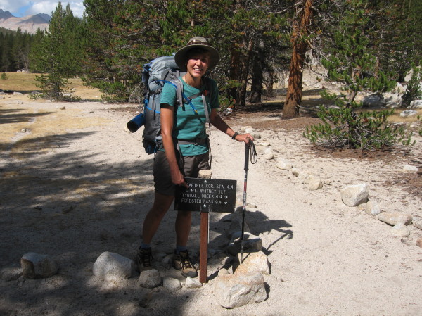
Day 5-Kern Hot Springs to Wallace Creek (12 miles, 10,409 feet)
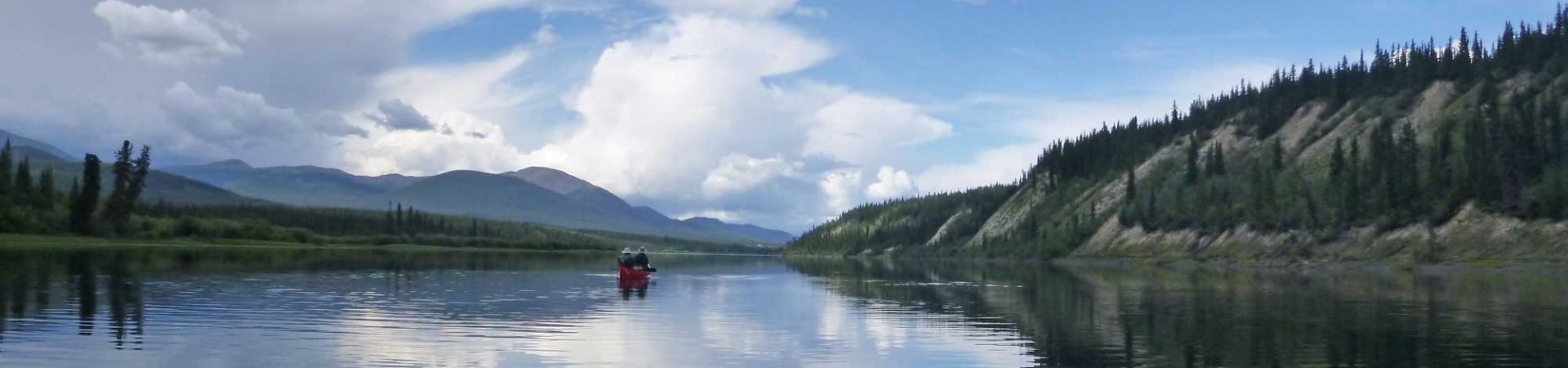
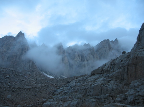
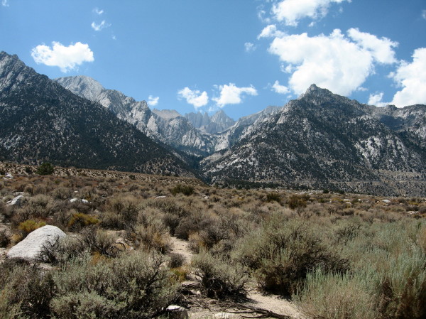
The Kaweah Mountains, our beacon in the woods
We didn’t mean to walk 12 miles but we did. We had planned another easy day to end at Junction Meadow, but it was just too easy. It was completely flat and we felt like our feet barely touched the trail, arriving at the junction by noon. The large site, which could accommodate many campers among the widely spaced trees, was pleasant so we soaked our feet in the river and ate lunch, ultimately deciding to press on. Unfortunately we were at the head of the canyon so there was no place to go but up, though the ascent was relatively gradual. We passed another potential campsite at the narrowest part of the canyon, the Upper Kern Basin, deemed it inadequate, and kept going to Wallace Creek. It was just a bit too far for my tired legs, which hadn’t recovered enough for the uphill part but I trudged on. I sat on a rock fighting back dog-tired tears when I heard the first and only drone of the fighter jets that day. This time they felt familiar and comforting, and the bravery of our troops, training for dangerous missions in unfriendly lands, pushed me out of my reverie of self-pity and I made it to the top, huffing and puffing. When the trail leveled out again, at the top of the opposite side of the Kern Canyon from where we started, I was blasted. Steve wanted to get to the junction of the JMT/PCT but when he saw how bushed I was he knew he had a mutiny on his hands and scouted out a superb campsite next to the creek. After a short rest and soak in the creek I revived and sat in wonder for the longest time watching the sun set over the serrated edges of the Kaweah’s, our beacon in the woods.
We had camped at one of the first campsites we found, and it wasn’t until the next day when we hiked out that we realized we were practically at the junction of the JMT/PCT, we were just at the far edge of the large camping area around the junction. We were both happy to discover that we were further along than we thought.
Day 6-Wallace Creek to Guitar Lake (7.7 miles, 11,480 feet)
Getting closer to Whitney! 11.7 more miles
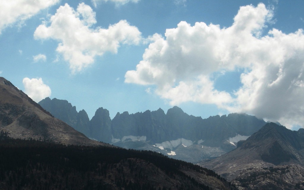
Again we got ahead of ourselves. We had planned to camp at Crabtree Meadow but since our starting point was further along than we had anticipated we again arrived at our proposed campsite at lunchtime. We debated back and forth. I wanted to stay down lower where there was possibly less risk of lightning strikes (though nearby Sandy Meadow was the site of the tragic lightning strike that hit a Boy Scout troop in 2005, killing one man and one teenager and injuring five others. Steve wanted to keep going so our Whitney summit day would be shorter, and his logic ultimately prevailed. He was feeling strong but I straggled up the last couple of miles to the bleak, treeless campsite at Guitar Lake and hunkered down next to a large boulder. The tent city was filled with hikers congregating on the windy slope in preparation for the next day’s assault. We gazed at a particularly ominous looking peak for a long time and took self-timed pictures in front of it, but then consulted a map and realized it wasn’t Mt. Whitney. We were basically right under Whitney but couldn’t get far enough away to see the top.
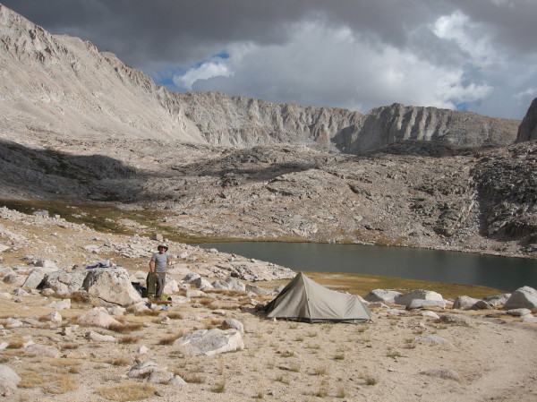
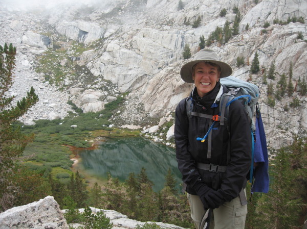
Steve at Guitar Lake. Our ascent of Mt Whitney will take place above his head and to the left.
I was tired and nervous about the next day so we ate dinner early and turned in shortly after dusk. Just as I was dozing off I heard the familiar drone. Night training began and I anticipated the runs overhead as the pilots did loops around Whitney, the hum barely audible at first, gaining in intensity until the crescendo built directly overhead, then waning with the Doppler effect only to repeat 10 minutes later. I sighed and got into the familiar rhythm. Quiet was restored at 10 p.m. and headlamps switched off across the plateau as hikers burrowed into their sleeping bags and the pilots headed home.
Day 7-Guitar Lake to Mt. Whitney to Trail Camp (9.1 miles, 12,014 feet)
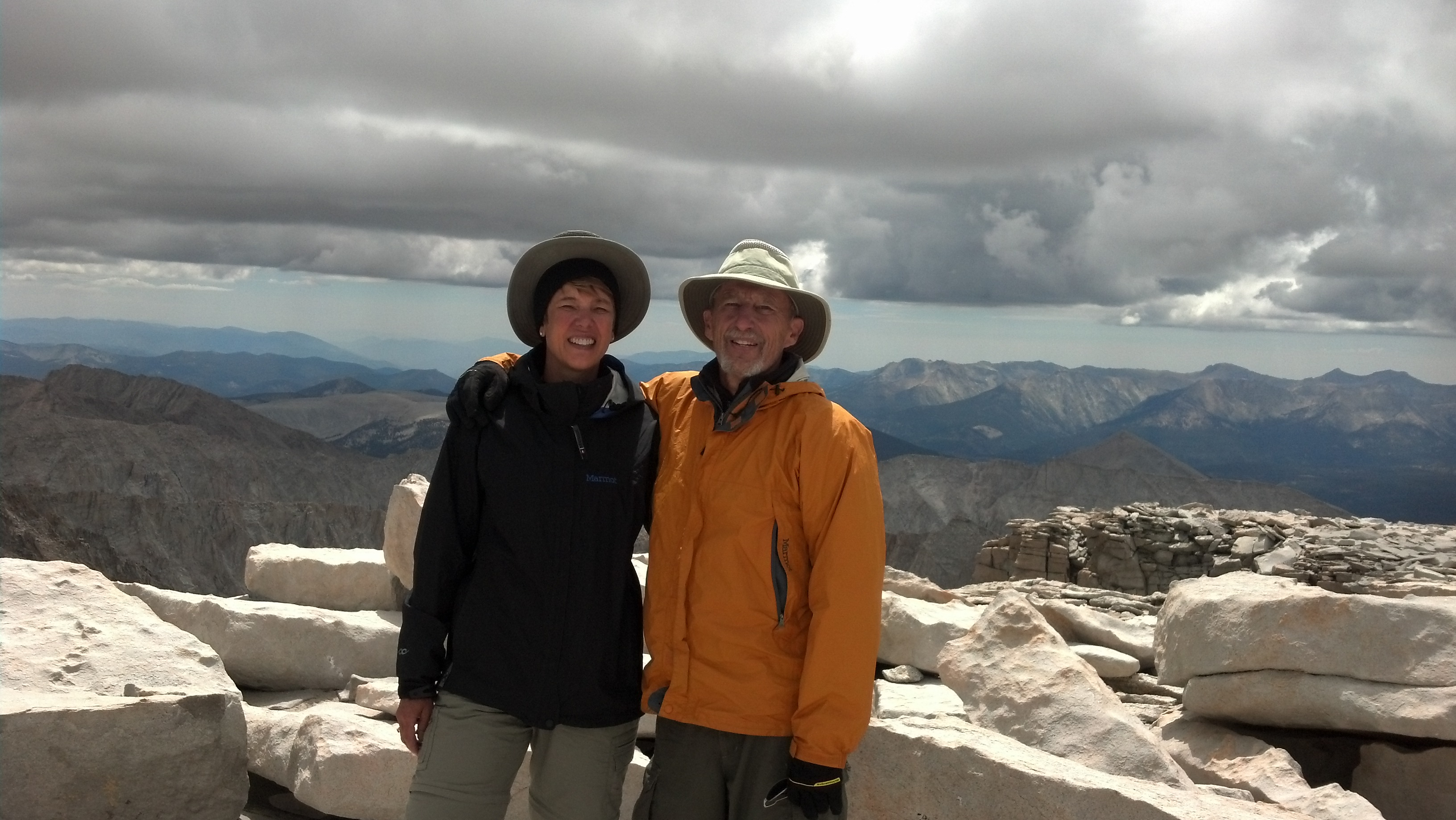
On top of the world! Summit of Mt. Whitney
I heard the muffled sounds of camps being broken down in the pitch black. I looked at my watch—3 a.m. I poked my head out of the tent and saw faint, bobbing lights already toiling up the trail. Not me–I snuggled back into my sleeping bag and blotted out the noise. We rose at 8 a.m., had a leisurely breakfast starting up the track at around 9 a.m. The ascent to the top was prolonged and steep with many switchbacks and the air was noticeably thinner at 13,000-14,000 feet. We took our time, stopping frequently, even if just for a few moments to catch our breath. When we got to Trail Crest we started co-mingling with a lot of day hikers, who looked very different from the through-hikers. They were neat and clean and wore lots of bright, new clothing, some of it appropriate.
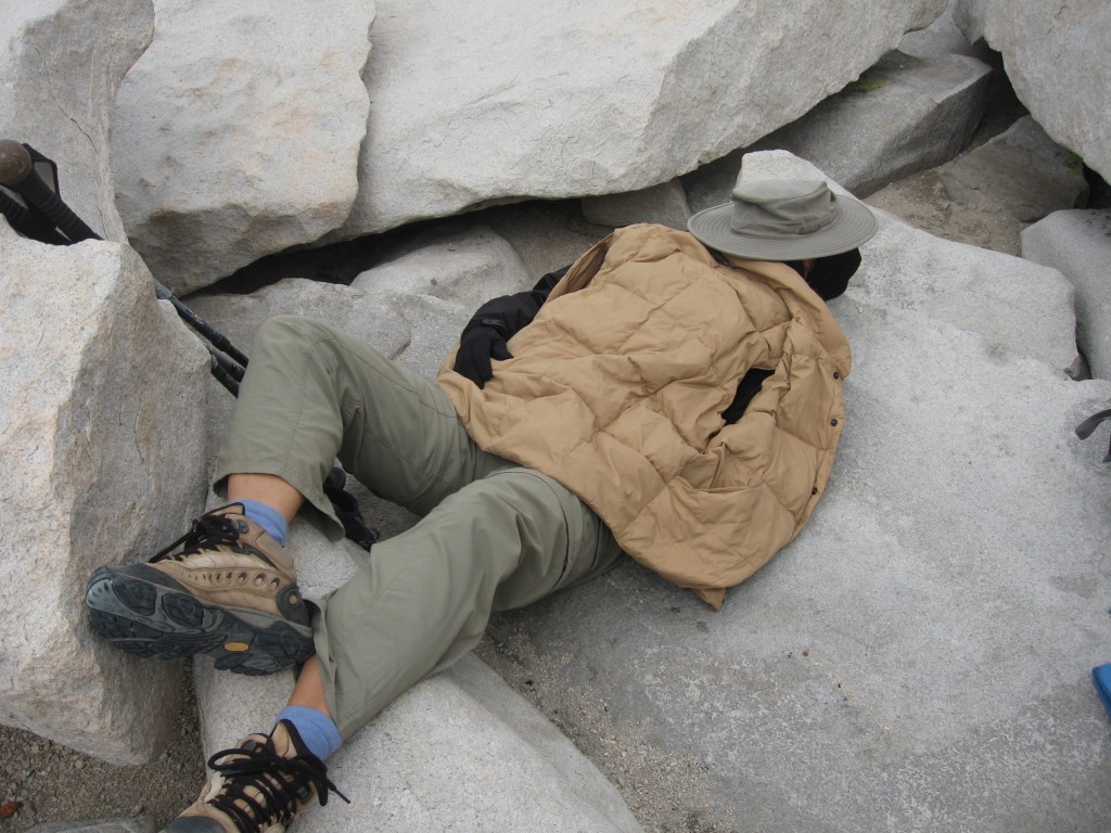
Tired girl
We had considered staying at the top overnight but before we even reached the summit we were chilled and though we had enough clothes it wasn’t appealing. I had a little headache and my eyes were puffy from the effects of the rarefied air, albeit mild. I knew that all I wanted to do was get up and then down.
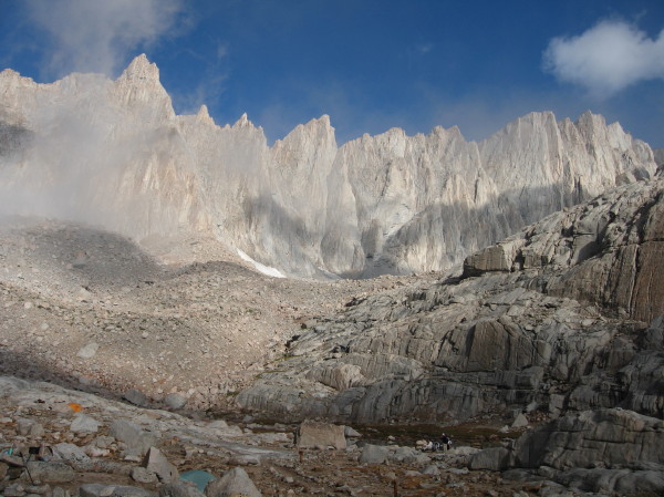
The view from Mt. Whitney was spectacular, and we spent a few minutes just soaking it all in. I saw the friendly Kaweahs to the west that had looked over us during our entire trip—this would be the last we would see of them for a very long time after we dropped over the other side. The dry, high desert of the Owens Valley stretched out to the east before bumping into the Inyo Mountains, while the jumbled masses of Sierra peaks marched north and south, beckoning us to continue. The peak of Whitney itself, the highest point in the contiguous U.S., was scattered with huge blocky slabs of granite that looked like giant building blocks.
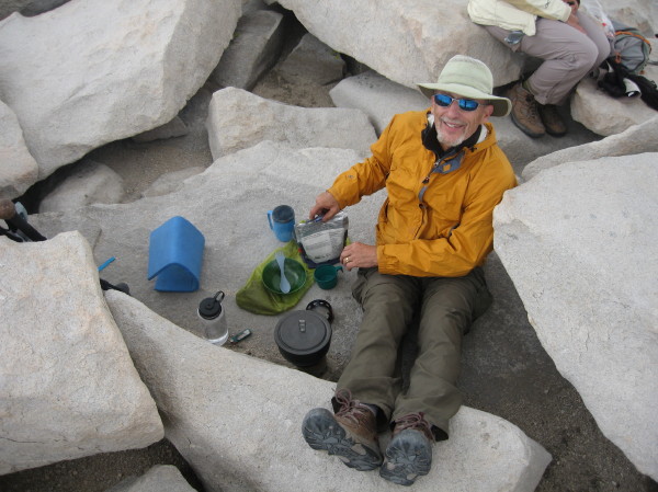
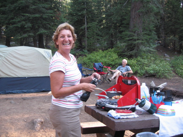
High altitude cooking
We were lucky that the weather was holding. Threatening gray clouds hung over us but the raindrops were held at bay. It struck me that the clouds seemed close enough to touch above our heads—since we were at 14,500 feet they really weren’t that far away. The small weather station, ubiquitous in photos of the summit, bristled with lightning rods and with its metal roof it’s no place you want to be in storms though the thought of potential shelter is tempting.
We signed the register and were touched to see a notation that a couple had gotten engaged on the PCT the day before–romance had bloomed on the trail like the wildflowers we saw all the way to the top.
After the initial excitement wore off I curled up between a couple of blocky boulders and took a nap while Steve patiently tried to start a high-altitude fire in our wood-fired camp stove with some twigs he carried from lower elevations. His persistence paid off and soon the kettle was boiling. I had no appetite but I forced some split pea soup down and it tasted ok.
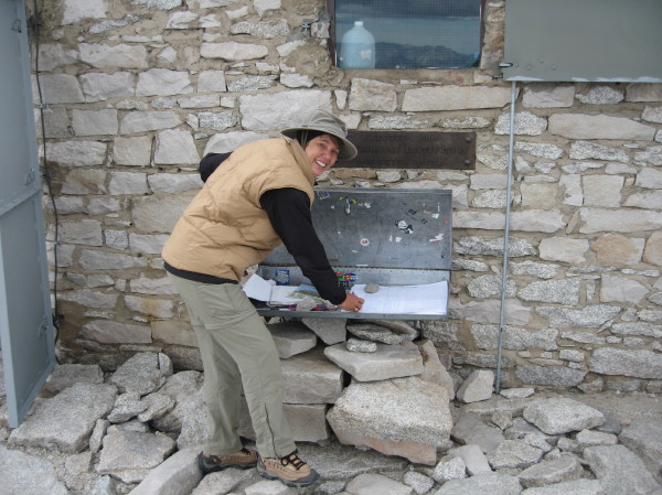
Signing the register is a rite of passage
When we headed down the 100 switchbacks to Trail Camp on the eastern side didn’t seem so bad, and it appeared that we would be down before we knew it. Not so fast—it’s an optical illusion. It’s true what they say—the switchbacks do eventually seem endless and you wonder if you will ever finish. A couple of sections were pretty tricky with a heavily eroded trail at the very top, so much so that I carefully planted my pole on the downhill side before swinging over it. After more than 60 miles of hiking this was the sketchiest segment, reflecting the impact of the 25,000 hikers that pound this part of the trail every year.
It was about 6 p.m. before we finally made it down to Trail Camp, the first camp on the eastern side of the Sierra, in a flat plateau next to a large pond. It was another tent city, with a mixture of people coming down and others preparing to go up the next day. It was a long but rewarding day and I was only too happy to set up the tent, eat a quick meal and drop into my sleeping bag.
Day 8-Trail Camp to Whitney Portal (6.5 miles, 8,306 feet)
Mt Whitney shrouded in clouds
We were awakened by muted booms in the distance. It was an eerie sight to see stars in the clear night sky above, but to look down on lightning illuminating the thick rain cloud far below us in Lone Pine, like watching a movie from behind the screen. I counted the seconds before the bursts of thunder. One one thousand, two one thousand, up to ten. No problem. I got to five the next time. Then it was, “one one thousand, oh my, that’s close.” My greatest backcountry fear is lightning, but when you’re lying in a metal-encircled speck of nylon on a rocky, exposed slope all you can do is philosophically wait it out, and presently I was counting to five again as the storm passed over us. I was exceedingly happy that I was not on the top of Whitney at that point.
Hiking down
I wasn’t excited about using the Wag Bag that I had hauled across 72 miles for use only in the Whitney Zone, but after seeing the disturbing amount of toilet paper and poorly disguised burial sites of mounds of poop on the thinly covered rocks I decided that it was for the best. It’s actually a pretty tidy way to dispose of human waste, but the logistics of using Wag Bags over the long haul would be daunting.
The last day was down, down, down, and intermittent rain drops drove us down even faster. I couldn’t help but stare at some of the day hikers in tank tops and shorts scrambling to unfurl their flimsy $2 ponchos when the hail rained down and the wind whipped through the narrow canyon. I saw a man carrying a bear barrel in his hands—that just couldn’t be comfortable all day. After a couple of hours of rain we passed a guy in a cotton sweatshirt who looked soaked to the bone.
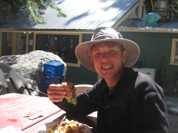
Burgers never tasted so good
I interrogated everyone we passed about the status of food, but many had started hiking in the wee hours and hadn’t been to the Whitney Portal Store. Then I started hearing tantalizing tales. “I hear the hiker’s breakfast is killer.” “My wife said they used to have great hamburgers.” Hamburgers! Burgers are not usually at the top of my wish list but I became obsessed. I could taste the charred meat, the doughy bread, maybe a tomato. I fantasized about French fries. And when we got there and bit into the giant hamburger it was everything I dreamed of and more, because the real French fries cut from potatoes on-site were irresistible and the huge chunk of lettuce and thick juicy tomato on the freshly grilled meat was heavenly.
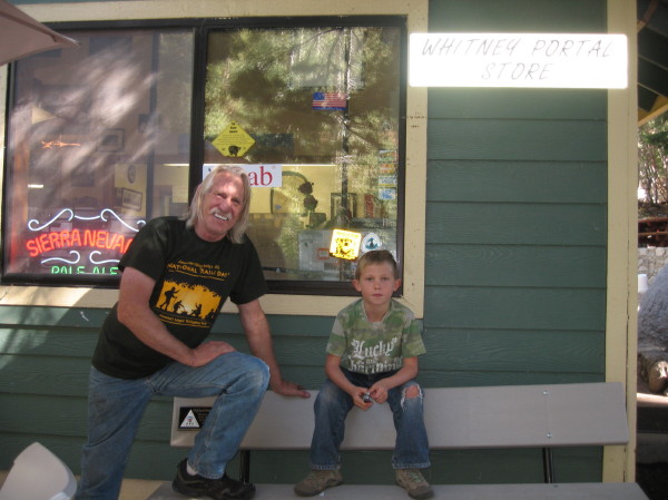
Doug Thompson, owner and chef at the Whitney Portal Store, with his grandson
We sated ourselves and rested but had to put off a hot shower for one more day since we finished a day early and our ride wasn’t due for until the morrow. We enjoyed chatting with hikers going up and coming down, had more rounds of burgers and beer and relished our last night sleeping under the stars at the Whitney Portal Hiker’s Campground (no reservations required), located a few steps from the end of the trail and the Whitney Portal Store.
When our friend Cindy arrived with coolers loaded with fresh treats we said our goodbyes to the mountain and our host at the Whitney Portal Store, the congenial Doug Thompson, and I mentally saluted the brave men and women who protect our country as they screamed overhead in their fighter jets, by now feeling an affinity for our steady companions as they accompanied us on our ambitious adventure.
Mt Whitney, center, from the desert around Lone Pine
Once we made the final descent into Lone Pine the desert terrain was somewhat of a shock after being in the mountains for a week but the shower at the comfortable Best Western was our sweet reward. We asked around and learned that the best restaurant in town was the Season’s Restaurant, where we enjoyed elk and duck, but best of all, a big green salad.
The High Sierra Trail was a strenuous, long-distance backpacking trip that stretched our capacity for planning but rewarded us with stunning views and a test of endurance that we were able to meet. Each day was completely different from the day before and continually surprised us with the variety of beautiful scenes to behold. The culmination of the hike on Mt. Whitney was a special experience, and hiking 72 miles from roughly 6,500 feet to 14,500 feet (with some major dips in between) was a major accomplishment for us. Now that we know we can hike that long in one stretch we’re setting our sights on the 210 mile John Muir Trail.
See related articles:
HIGH SIERRA TRAIL, PART 1: OVERVIEW
HIGH SIERRA TRAIL, PART 2: START TO DAY FOUR
HIGH SIERRA TRAIL, PART 3: DAY FIVE TO END
REACHING NEW HIGHS ON ALTA PEAK
THE WONDERS OF SEQUOIA NATIONAL PARK
All photos by Inga Aksamit and Steve Mullen.
Information:
Sequoia National Park
86724 Highway 180
Sequoia National Park, CA 93262
559-565-3341
SEKI is the combined Sequoia and Kings Canyon National Parks
63204 Lodgepole Road
Sequoia National Park, CA 93262
Open early spring through late fall, may be open weekends in winter.
Guidebook
Hiking Sequoia and Kings Canyon National Parks, by Laurel Scheidt, contains information and detailed maps about the first part of the hike.
E-Guide-EveryTrail
An excellent detailed guide to the trail in seven segments.
Map
Tom Harrison’s Sequoia and Kings Canyon National Parks Recreation Map
LODGING:
Wuksachi Lodge
64740 Wuksachi Way
Sequoia National Park, CA 93262
866-807-3598
For lodging prior to the hike the comfortable Wuksachi Lodge is the only option in the park other than camping. This full service lodge has large, well-appointed rooms with free Wi-Fi, mini-refrigerator and flat screen TV. The Peaks restaurant serves a breakfast buffet, lunch and dinner featuring a locally-inspired menu, and the bartender mixes some mean cocktails. A small lobby has comfortable sofas and chairs around a large wood-burning fireplace.
Cindy, our trail angel, who picked us up in Lone Pine and brought luxury supplies for car camping at Mineral King
There is a large campground at Lodgepole that fills up quickly. The Dorst campground is a good alternative prior to the hike.
Whitney Portal:
There is a hiker’s campground a few steps from the end of the trail and the Whitney Portal Store. There are also several motels and hostels in the nearby town on Lone Pine on Highway 395.
Best Western Frontier Motel
1008 South Main Street
Lone Pine, CA 93545
760-876-5571
Whitney Portal Hostel
238 South Main Street
Lone Pine, CA 93545
760-876-0030
Getting There:
To reach the western entrance of Sequoia National Park from San Francisco by car (approximately 5 hours, depending on traffic and weather):
Mt Whitney
Natalie says:
Hi Inga!
I finally opened my blog, and it’s natventuresusa.wordpress.com !
I did the Whitney hike in 2011, and it was great! It was funny looking at some of your photos and thinking, “I remember that!”
Happy Spring!
~Natalie