


Chilkoot Trail Trailhead
As we ascended from sea to summit on the Chilkoot Trail my thoughts wandered back to the footsteps that came before us, back to the Klondike gold seekers of the 1890’s, and even further back, to the original bushwhackers who created and controlled the trail centuries ago. The indigenous Tlingit’s (pronounced klinkit), tall and rugged warriors of the north, were known for their wilderness skills and aggressive nature. Their footsteps pounded the arduous “Grease Trail” up and over the Chilkoot Pass to carry their oolichan (an oily smelt) harvest up the trail to trade with the interior Athabaskans in exchange for furs, tanned hides and copper. The path they carved out of the thick forest and solid granite supported our footfalls in a passage back in time.

White Pass and Yukon Route Railroad
My husband, Steve, and I became fascinated with this historic trail, known as the Klondike Gold Rush International Historical Park, on a visit to Skagway, Alaska many years ago. While riding the White Pass and Yukon Route Railroad we spotted some backpackers and the seed was planted. We plotted, planned, organized and finally stalled, mostly because I had no backpacking experience whatsoever. We began hiking more, then strapped on backpacks for weekend trips, finally building up enough stamina to face the rigors of a five day wilderness trip. Plans were laid, books were read, internet searches completed. Tickets to Juneau and Skagway were purchased and we were committed. Friends, Jim and Julie, had also become fascinated with the history of the area, and accompanied us.
I now have countless backpacking trips under my belt, many in very beautiful places. Most have been in wilderness areas on less popular trails than the Chilkoot Trail; all were easier to get to. But the Chilkoot Trail is special, and while the natural beauty is stunning in its own right and the history fascinating, it contains other unique features. Half is on the American side of the border, while the other half is on the Canadian side. The two halves are not only divided by an international border at the 3500 foot apex, but by differing topography. The American side receives all the drippy, misty, drizzly, wet weather the Northwest can throw at it; consequently is green and lush, populated by hundreds of multi-hued mushrooms nestled beneath the towering cedars, leafy cottonwoods and sturdy Sitka spruce. Drier and colder, the Canadian side, initially above the tree line, is full of great slabs of granite, gurgling streams and wide open meadows, punctuated by a growing chain of crystalline, azure lakes that form the headwaters of the mighty Yukon River.

Irene Glacier
Getting a late start on the first day we hiked the scant to Finnegan’s Point Camp on a gentle incline, traversing though boggy sections on narrow boardwalks. Directly across the Taiya River we could see the hanging Irene glacier forming a foaming waterfall. As we sat on the side of the river with binoculars in hand, we gazed at the snow and water sculpture high in the heavens and discussed bears. Julie, a professional firefighter and experienced outdoorswoman, has an irrational fear of bears, causing most conversations to veer toward some analysis of current bear dangers, sprinkled with regret over not acquiring bear repellent (pepper spray) in Skagway. While my head was filled with the ghosts of past footsteps, Julie’s thoughts were squarely focused on the bruins we shared the trail with in the present. We examined every steaming pile of berry-filled bear scat, investigated every twig snap, compared and contrasted features of black and the more aggressive brown (grizzly) bears, and recounted every bear story we could think of. Although we told her we had never actually seen a bear on any of our many trips to the North, three guys from Anchorage rolled into camp excitedly telling us of a bear sighting a few minutes prior, destroying our credibility. That was it—Julie was convinced her life would end right here on the Chilkoot Trail, and she made her peace with it. The guys spent the entire evening regaling her with stories of recent bear maulings around Anchorage, providing ready material to populate her misgivings.

Inga on a suspension bridge
The next two days we toiled up the trail, crossing wobbly suspension bridges and relentlessly gaining elevation. We cursed our packs and regretted any small luxury that added unnecessary weight. The forest was thick with green layers of foliage. Brilliant green soft mosses, light feathery ferns, and masses of broad leafed berry bushes provided the understory beneath stately cedars piercing themists, seeking shards of sunlight. I discovered that Tony, one of the Anchorage guys, was a fount of knowledge about berries, easily distinguishing between edible, desirable, tasteless and dangerous. I collected samples along the way and peppered him with questions every evening as he patiently identified highbush and lowbush cranberries, crowberries, red and black currants, watermelon berries and salmonberries. Julie’s fear was at a steady state as signs of bears were scarce, but the evening bear stories continued, the Anchorage guys now fueled by an avid audience.

Wooden headstone along the trail
Laboring up endless steps chiseled out of granite we had countless opportunities to observe the many artifacts from the gold rush along the trail, providing props to populate our imagination as we considered the obstacles the prospective miners had to overcome. Remnants of lonely cabins, a leather boot here, a pile of tin cans there, stoves used to chase away to penetrating chill of the Northwest, were all visible along the trail. A faded wooden headstone reminded us of the hardships that caused many to perish along the trail.
As we neared the summit that separates the US from Canada, rivulets of water cascaded down gigantic, smooth walls of exposed granite that poured with the water of a thousand shimmering waterfalls cascading from the heavens. We were out of the temperate rain forest, ready to cross into another, high alpine, land.
At Sheep’s Camp, the last camp before the summit, small clumps of people listened intently as the ranger delivered the nightly address on conditions and safety. Everyone knew that the morrow would require a great deal of effort, starting with a 5 a.m. rise. Everyone was subdued, each thinking about what they had read or heard about the next day’s journey. There was very little story telling and everyone turned in early. Anyone who didn’t make it to the base of the Scales by noon would be turned back due to avalanche danger and the decreasing likelihood that they would make it to a safe camping place by nightfall.

Julie & Steve at first sighting of snow
We rose in the dark and our group being fit, made good time to the base of the Scales where the prospectors used to have their goods weighed before entering Canada. We stowed our walking sticks and clambered up the steeply angled boulder field known as the Golden Stairs, made slippery by the dripping mists. Using handholds on the boulders we pulled ourselves up to the false summit, and then tiptoed across dangerous snow bridges to the true summit. A howling wind and precipitation provided a typical Canadian greeting. We peered through the vapor, surprised to find a huge snowfield stretching before us, despite the calendar showing that it was mid-August. After a short rest in the warming hut steaming with the effort of much exertion, we struck out, wishing for ropes and crampons, and perhaps an ice axe. A nasty traverse of footprints had thawed and refrozen providing rounded icy hillocks that prevented good purchase. As the wind caught my pack I spun around on the sastrugi more than once, using my walking stick to maintain balance, conscious of the boulders lining the shore of the iceberg-filled Crater Lake below. A fall here would be dangerous indeed, and I breathed a sign of relief when we exited the snowfield. Many more snowfields followed, but none as dodgy. The constant danger of avalanches kept us moving, while the sun tantalized us with the promise of blue skies enticed us down the trail. Gradually, the weather improved and glittering blue, crystal clear lakes beckoned, forming the headwaters of the Yukon River. Improbably beginning these from the sea, the Yukon River is forced into a tortuous course that takes it 2,000 miles north and then west to the Bering Sea.

Deep Lake
We made good time, passing Happy Camp where most hikers stop, instead opting to continue another mile to the less populated camp at Deep Lake. We arrived nine hours after starting and then listened to the recounting of the summit tales as people followed, some taking significantly more than 12 hours. The tension released, everyone was in a celebratory, chatty mood. Small bottles of libations appeared and stories once again flowed. A ranger appeared from the Canadian side, clutching bear spray in one hand, her radio in the other. Looking a bit shaken, she had just seen two large bears, one black and one brown, stoking Julie’s fears once again. Luckily fatigue overcame us and we retreated into our tents early.
Jim and Julie had to hustle to catch the train the next day, while we were planning to make our way down in a more leisurely fashion, so when we arose they had already departed. We took our time breaking camp and set off, munching on fresh blueberries from the bushes along the trail. Early in the afternoon we rounded a corner to see a brown snout poking inquisitively from the bushes. As much as we had been surrounded by bear talk the entire trip we were shocked to actually see the little guy. He looked like a juvenile, and he was definitely more afraid of us than we were him, wheeling around and crashing through the brush as he beat a path away from us. We were a bit chastened though, wondering if more of the bruins were around. I wanted to hurry down the trail, but Steve was having some technical difficulty with his pack and wanted to stop and make some adjustments. While I stood nervously scanning the brush, the guys from Anchorage rounded the corner, to my great relief. I knew Brian was carrying bear spray so I helped Steve quickly stow his gear while we filled them in, and then shadowed them on the trail.

Bear (courtesy of G Morgan)
A few miles down the road we had mostly forgotten the bear encounter when we came upon the guys from Anchorage peering through their binoculars at a larger black bear off in the distance. We were nearing Lindeman Camp, where we had been warned of recent bear activity and it was living up to the reports. Another couple joined our growing group and we moved together down the trail toward camp. We heard twigs snapping on the hill above us and found ourselves looking directly at a large bear headed directly toward us. Several of us moved quickly forward, while other held back, with the trajectory of the bear now splitting our group in half. We waited awhile and were grateful to see our friends rejoin us, exulting over their close up photos of the bear. While I thought their behavior a little crazy, I appreciated Greg’s close-up bear photos later. The trail curved back around the hill in a lazy switchback, so we found ourselves again approaching the path the bear was taking down the hill. We stopped to watch him roll some stones around, unearthing something delectable. We debated our next course of action and decided to keep moving down the trail. When we made the final switchback around the hill we joined the bear one more time at the sign announcing that we had made Lindeman Camp, but we didn’t feel very welcome at this end of the large camp. The bear showed no signs of fear toward our group, and also no signs of wanting to move on. So we did a little dance, keeping the large sign between our group and the bear, adjusting our position as he adjusted his. This went on for some time until he ambled off toward the outhouse, leaving us a window of opportunity to dash to the other end of the camp. After the ranger said the bear had swiped an unoccupied tent the day before, ripping into the nylon we debated about staying there the night, but ultimately decided to risk it because we wanted to visit the small tent museum chronicling the Klondike gold rush, and the interior Athabaskan and coastal Tlingit tribes. We were more than careful about packing any and all food into the bear-proof lockers provided. Once we settled down we enjoyed the beautiful views of Lake Lindeman, took a brisk swim in the warmer (but still chilly) waters and enjoyed a sunny afternoon relaxing and perusing the museum. Jim and Julie missed the excitement of the bear sightings, but have plenty of second-hand bear stories to tell, courtesy of our camp mates. We slept soundly that night, peacefully co-existing with the bruins and anticipating the end of this portion of the trip.

Inga with Greg, Tony & Brian (holding bear spray)
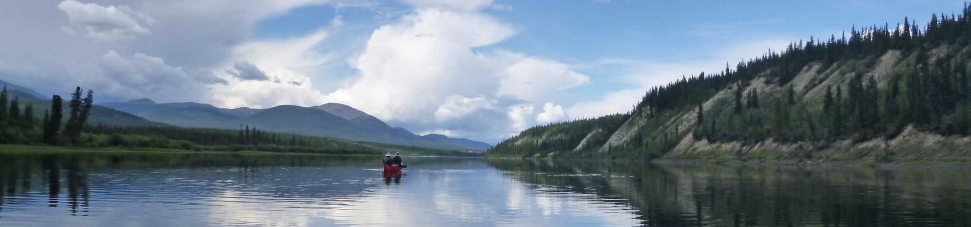
The next day we hiked the easy, mostly level path to enormous Bennett Lake where we would catch the White Pass and Yukon Route train to Whitehorse, seeing ample evidence of bears as large footprints appeared in the soft mud. We tapped our walking sticks endlessly to announce our progress, tap, tap, tapping our way down the trail. We stopped for lunch at serene and beautiful Bare Loon Lake, listening to the plaintive call of the loons reverberating across the lake. Reaching Bennett Lake in the afternoon we pitched our tent along the shore and examined the many artifacts from the thousands of gold rush seekers who gathered on the shore to build their small rafts and set off on the watery highway down the Yukon River to Dawson City. They were all hoping to find riches, but most found only the adventure of a lifetime as they learned the secrets to survival in a harsh northern land from those who had existed there for centuries. We felt privileged to walk in their footsteps, conscious of their dreams echoing in the forest, with a heightened appreciation of the ancient ways of the Tlingit people.
Planning your Chilkoot Trail backpacking trip
Exploring Whitehorse, Yukon Territory, Canada
Planning your Yukon River canoe trip
The Hungry Spork: A Long Distance Hiker’s Guide to Meal Planning (book)
U.S. National Parks Service: Chilkoot Trail
Parks Canada, Chilkoot Trail: Permits and reservation information
Explore North: Detailed trail description (1998)
Chilkoot Trail and Yukon River Travel Facebook Group
See my story, “Bear Encounters on the Chilkoot Trail”, in Travel Stories from Around the Globe, available in the Kindle store:
5 thoughts on “A Northern Wilderness Adventure-Alaska to British Columbia on the Chilkoot Trail”