


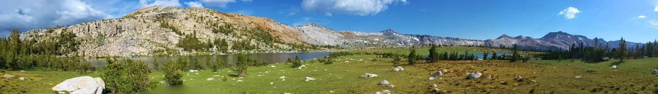
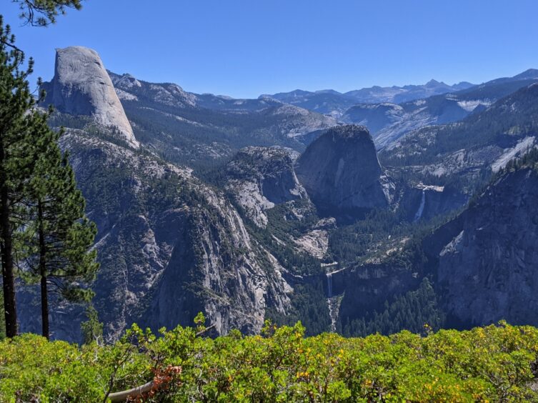
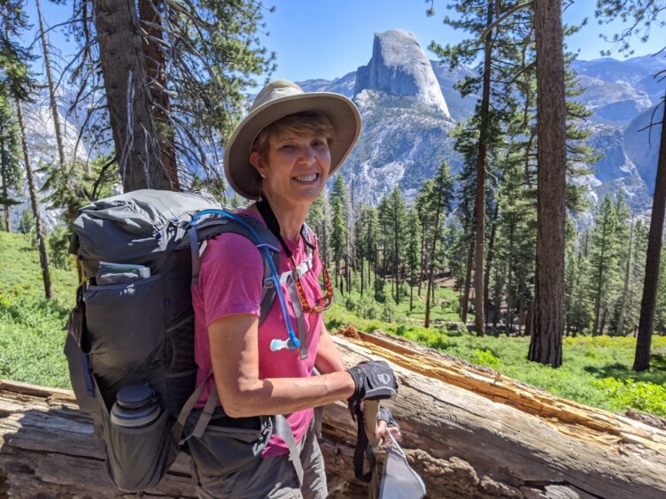
Glacier Point is graced with some of the most stunning views in Yosemite National Park, with a panorama of peaks, valleys and waterfalls, including the iconic Half Dome rock formation front and center. There could hardly be a more spectacular start to a multi-day hike. Add to that a plethora of trailheads and potential routes and there are untold options for planning your own Southern Yosemite loops.
This article is less of a trip report and more of an attempt to inspire anyone interested in an excursion like this to gather your resources, put your thinking cap on, find the patterns and plan your own journey. It’s easy to follow a classic route like the John Muir Trail or the Pacific Crest Trail, but the pleasure of plotting a course based on your own preferences, researching the terrain and elevation profiles and getting excited about the wonders you might encounter are an enjoyable pastime with many rewards.
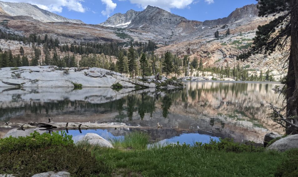
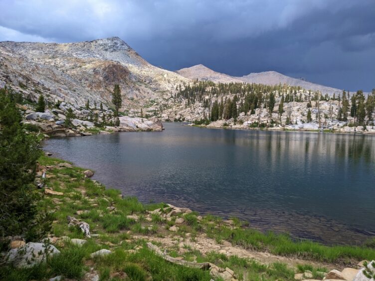
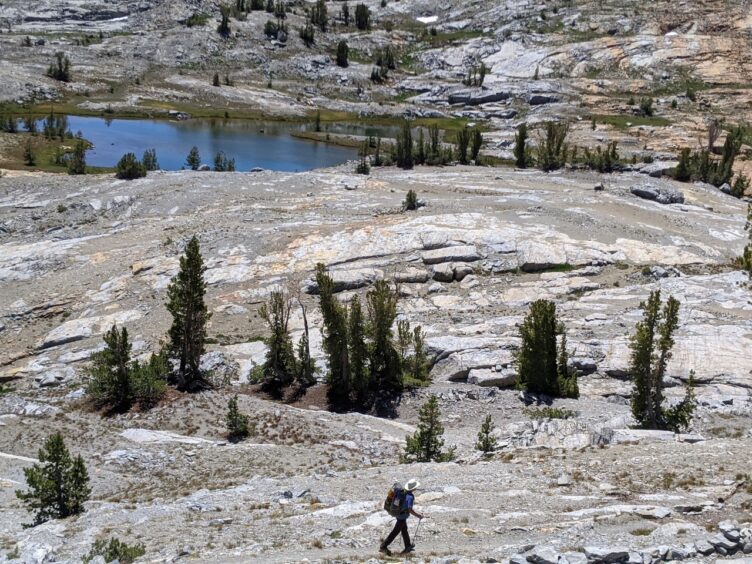
Some of the highlights you may experience are unexpected, stunning views of the Ritter Range from several high passes, lakes that rival those found in the Tuolumne area, a sampling of dramatic geologic wonders and the opportunity to explore the headwaters of the Merced River and areas of historic significance.
If planning your own trip is new for you, take advantage of traditional and non-traditional tools. Gather your resources (see links below under “Resources”) and get a good Tom Harrison topographic map that you can spread out in front of you. Seeing the whole map of Yosemite will allow certain circular routes to come into focus. You’ll spot famous landmarks that may draw you toward them to experience their wonders or repel you away from the crowds. You’ll see how enormous the lightly traveled northern part of the park is and how many trails veer off from Glacier Point Road into the southern reaches.
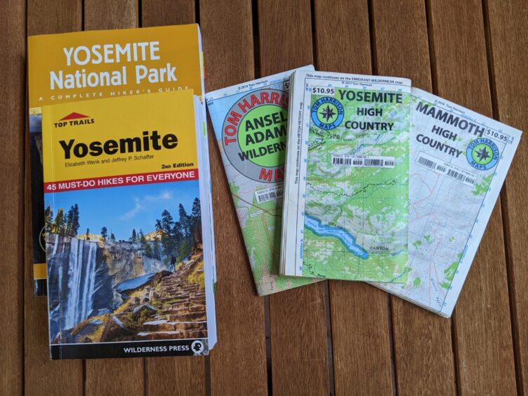
Dive into a computer program such as Gaia GPS or CalTopo to get a quick look at elevations and different map overlays. You can plot your route to upload to your phone or print. You can get an elevation profile to see if you’ve bitten off too much for a day when you realize that you’ll be climbing 3,000 feet or more. You can invest in a quality guidebook such as Elizabeth Wenk’s Top Trails Yosemite or Yosemite National Park: Your Complete Hiking Guide (or other Wilderness Press guidebooks) and check blog reports or YouTube videos. When you get the basic outline, dive a little deeper to see if you can find creeks or lakes for your campsites or plan where you’ll get your last water before dry camping. You’ll probably crave more maps when you realize that to the north and south, Yosemite trails merge with trails in other wilderness areas and if you’re like me, you’ll want to know where they go. And then you’ll want to hike them.
A nice feature of staying in or close to the park is that the logistical challenges of transportation, parking and resupply for long trips are minimized. The easiest is to plan a loop so you can return to your vehicle but if you make your way to Yosemite Valley or Tuolumne Meadows, you can take public transportation to return to your car (these are subject to change in Covid times so be sure to check for updates).
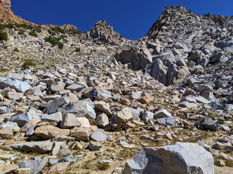
We started our 60-mile hike at Glacier Point but all along Glacier Point Road are other trailheads that cut through meadows and over ridges, resulting in a fine network of trails. This means that there are multiple permit opportunities to be able to access similar terrain and routes. One option is to head south toward Chiquito Pass (8,071 feet) or Fernandez Pass (10,213 feet). You’ll also notice that there’s a big blank spot southeast of Glacier Point that is blocked by the Clark Range. One passage through the Clark Range is Red Peak Pass (at 11,158 feet, this is the highest trail pass in the park) so this is a common destination to gain access to the next basin. To get a historical perspective, read John Muir’s book, “The Mountains of California.” Despite his imperfections, he was a great explorer and his discovery and description of the Merced Glacier above Ottoway Lakes ranks among his best work.
Once you’re over Red Peak Pass, a whole new world opens up with routes that can take you back to Yosemite Valley, over to Tuolumne Meadows or south, out of the park and into Sierra National Forest and the Ansel Adams Wilderness via Isberg Pass (10,520 feet) or Post Peak Pass (10,617 feet). The views of the Ritter range and Minarets offer a dramatically different perspective compared to the usual sightlines from the John Muir Trail.
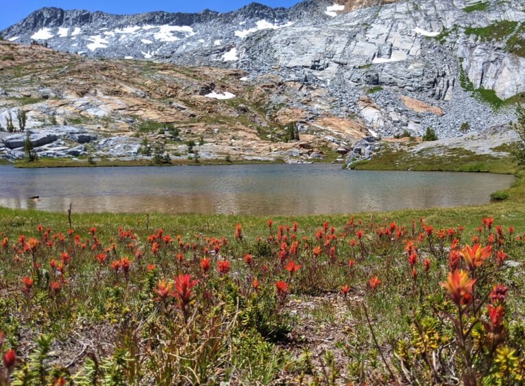
If you study the routes in the Ansel Adams Wilderness, you’ll see that by dipping southwest, you can loop, within 10 miles, back into Yosemite National Park while visiting some beautiful high alpine lakes along the way. In late season, head for the lakes as streams can dry up and are not reliable sources of water.
Clover Meadow Campground is a major landmark in Sierra National Forest, with road access and a ranger station. Many loops can be planned from Clover Meadow going into Yosemite or heading east toward Mammoth Lakes. You’ll want the Tom Harrison Ansel Adams Wilderness Map for trip planning originating from Clover Meadow. Note that this area was affected by the 2020 Creek Fire so check whether trails are open.
Sticking with our loop, you could choose to visit any number of scenic lakes in Sierra National Forest and re-enter Yosemite via Fernandez Pass. From Breeze Lake (named after William Breeze, who helped map the area, and the weather often matches the name), at the headwaters of the Merced River, look up to the ridge to spot Sing Peak (10,530 feet), named after Ty Sing, one of the many Chinese Americans who supported the exploration and building of the park. For 28 years Sing was the chef for the field kitchen that supported the expeditions of the United States Geological Survey. When you’re ready to tackle some easy cross-country navigation, Sing Peak could be a destination. From Moraine Meadow at the headwaters of the Merced River, you can plot a route back to your starting point that is different from the one you started on.
Whether you’re a new or experienced backpacker, there are loops and routes in Yosemite that are sure to appeal to you. There are potential routes that are short or long, easy or challenging but all feature unique terrain and stunning views. All you need to find a route is a map and your imagination.
Top Trails Yosemite by Elizabeth Wenk and Jeffrey P. Schaffer (Wilderness Press, 2018). This guidebook contains 45 of the best hikes in the park with clear, easy-to-read maps, elevation profiles and descriptions.
Yosemite National Park: Your Complete Hiking Guide by Elizabeth Wenk and Jeffrey P. Schaffer (Wilderness Press, 2021). This is a comprehensive guide to the trails in the park.
Yosemite High Country-Tom Harrison Map or Amazon
Ansel Adams Wilderness-Tom Harrison Map or Amazon
Gaia GPS mapping and route planning application
CalTopo mapping and route planning application
Thank you to Elizabeth Wenk and Peter Hirst for reviewing this article.
Inga says:
Testing
Aron Ray says:
Nice Writing.
Hilary says:
Another great post. I have done John Muir and some other multi-day hikes but have never been brave enough to do it without having a tour leader. I would love to see some more of those glorious high alpine lakes especially after going to Marie Lake last year- so perfect and stunning that I kept thinking unicorns were going to appear.